Use Cmd/Ctrl+F to search Native American Tribes
Working links are Red, other references, use Navigation Panel choices.
Names in bold will be found in Players or Dictionary
Bolded Titles in References – Books (two lists).
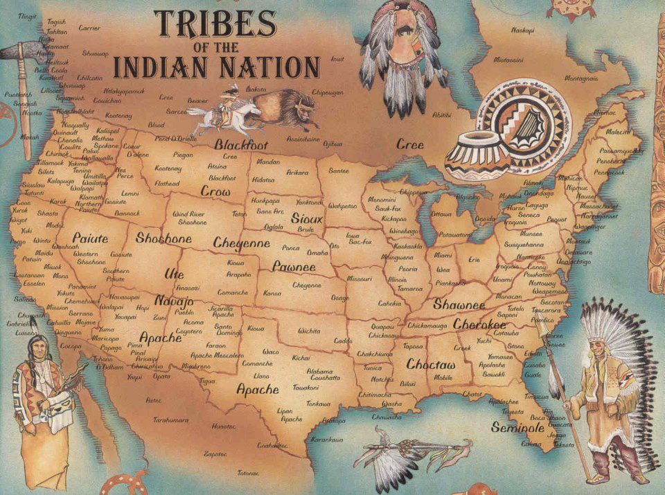
Native American Tribes
There is NO PAYWALL on this page.
Here is a partial list of Native American Tribes (mostly Western)
along with most of the references to them in The Old West Daily Reader.
Another of those complicated, involved sections which I work on periodically.
Always adding new material… Doc
Beginning in the 1500’s, the horse, acquired from the Spanish, caused significant changes to the lifestyles of many Native American tribes. Dramatic as those changes were in the west, they didn’t hold a candle to the coming of the white man. Tribal territories, affiliations and lifestyles; everything changed dramatically over a period of about 150 years; some six or seven generations. The last two or three of those generations faced the full onslaught of the white culture. The time period we consider the Old West encompassed the final battles and the subjugation of the remaining free tribes; known as the Indian Wars. * Some tribes were decimated outright by disease or conflict. Others migrated either by choice or by force; often moving west because of tribes east of them, now armed with the white man’s weaponry, were themselves being displaced by the whites. The destruction of the buffalo herds and the associated devastation to the tribes, disrupted the self-sufficient lifestyle of Indian people more than all other federal policies. By the end of the 19th Century, the Native American population was only 237,000, down from one million a century earlier. Native Americans spoke more than 300 different languages across North America. Today, there are about 170 Native languages still viable. The snapshots of the tribes presented here are very limited and only intended to offer context for an approach to this incredibly complex story.
Please keep in mind: The Native Americans are the ultimate authorities on their own histories.
see:
The Originals Index – Timelines -A-L Index – Indian Wars Timeline
The Originals Index – Horses
Note: Tribal Great Seals and flags are a modern convention acquired from the white culture.
They did not exist in historical times.
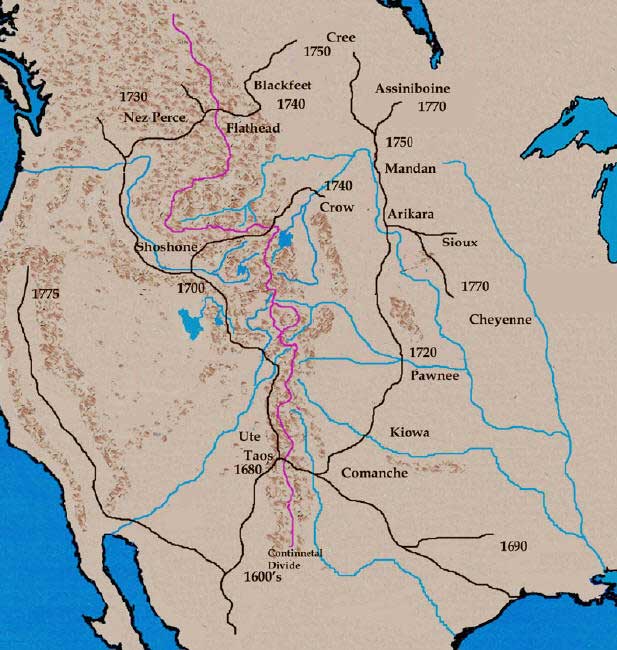 Indian Horse acquisition map
Map from the University of Idaho
see also:
The Originals Index – Horses
California Indian Tribes
If I couldn’t find the Tribal seal, I look for a book cover or art that represents the tribe.
* at the bottom of a listing = No seal. – Doc
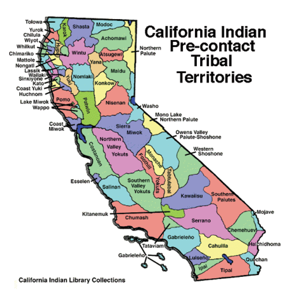
Map of California Indian Tribes – pre-contact
© CA Indian Library Collection – Fair Use
![]()
Achomawi
Northeastern CA, Pit River.
*
![]()
Cahuilla
Southern CA in Palm Springs Canyon and the Sonoran Desert.
Today’s Population estimate (2024)
Tribe alone:
Tribe alone or in any combination:
see:
Wk. 49, 12/06/1846 – Temecula Massacre
![]()
Chumash
aka: Santa Barbara Natives
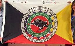
Chumash
aka: Santa Barbara Natives
On the CA Pacific coast, San Luis Obispo to Malibu Canyon, inland to the San Joaquin Valley
First European contact was the Spaniard, Juan Cabrillo (1542).
Today’s Population estimate (2024)
Tribe alone:
Tribe alone or in any combination:
![]()
Ohlone
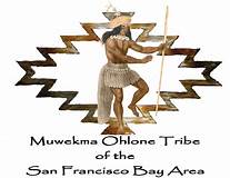
formerly known as Costanoans
Pacific Coast, south of San Francisco Bay
Today’s Population estimate (2024)
Tribe alone:
Tribe alone or in any combination:
![]()
Digueño
Southern CA.
*
![]()
Hoopa
Southern CA.
Hupa – aka: Hoopa)
Along the Trinity River in Northern CA.
Today, largest reservation in CA.
Today’s Population estimate (2025)
Tribe alone: 5,000+
![]()
Karuk
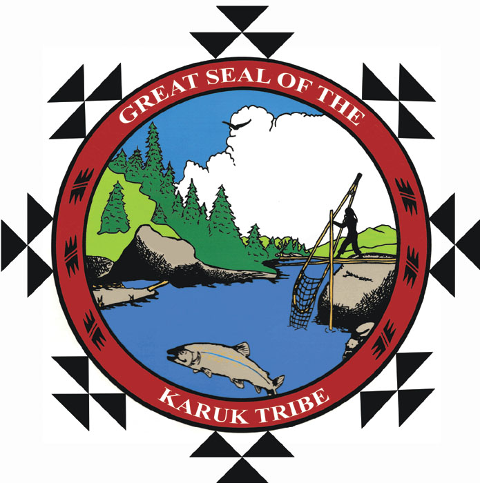
Northern CA, along the Kamath River.
One of the largest tribes in CA.
Today’s Population estimate (2024)
Tribe alone:
Tribe alone or in any combination:
![]()
Kawaiisu
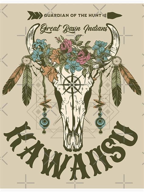
Southeastern CA, San Joaquin Valley to the Mojave Desert
Poster by Redbubble
Today’s Population estimate (2024)
Tribe alone:
Tribe alone or in any combination:
![]()
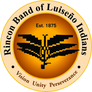
Luiseño Indians, Rincon Band seal
Image: U.S. ©, Fair Use
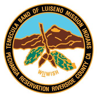
Luiseño-Indians-Temecula-Band-seal
Image: U.S. ©, Fair Use
Luiseño & Juaneño
Payómkawichum
(People of the West)
Inhabited the
Temecula Valley
in the coastal area of southern California.
Ranging 50 miles from the present-day
southern part of
Los Angeles County
to the northern part of San Diego County, and inland some 30 miles.
First contacts with the Spanish in the 16th century.
Today’s Population estimate (2024)
Tribe alone:
Tribe alone or in any combination:
see:
Wk. 49, 12/06/1846 – Temecula Massacre
![]()
Maidu
Northern CA, Sacramento Valley and nearby Sierra Nevada.
Today’s Population estimate (2024)
Tribe alone:
Tribe alone or in any combination:
![]()
Mendocino
Northern CA part of the Pomo culture.
Today’s Population estimate (2024)
Tribe alone:
Tribe alone or in any combination:
![]()
Miwok
Western slope of the Sierra Nevada in central CA.
*
![]()
Modoc
Northern CA near the Klamath River and into southern OR.
(Kalamath Resevation in OR)
Today’s Population estimate (2024)
Tribe alone:
Tribe alone or in any combination:
see:
Modoc War, included in: Timelines Index – Timelines A-L Index – Indian Wars Timeline – find 1872 (8 entries)
Wk. 48 – use Control +F ( find), search for: Modoc on linked pages
Wk. 40, 10/03/1873 – The Modoc War (Hangings, and a cost assessment.)
![]()
Pomo

Northern CA coast and the Russian River Valley.
Today’s Population estimate (2024)
Tribe alone:
Tribe alone or in any combination:
![]()
Salinan
South central CA.
Today’s Population estimate (2024)
Tribe alone:
![]()
Shasta
Northern central CA.
Today’s Population estimate (2024)
Tribe alone: 653
![]()
Tolowa
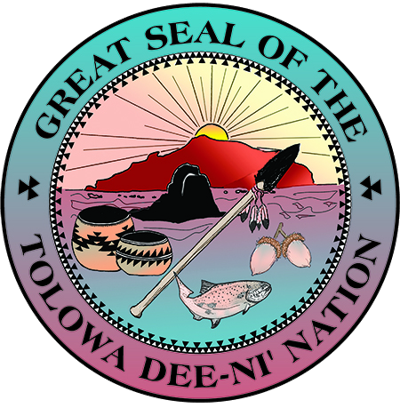
Northern CA, coast
Today’s Population estimate (2024)
Tribe alone:
Tribe alone or in any combination:
![]()
Wintun
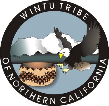
Today’s Population estimate (2024)
Tribe alone:
Tribe alone or in any combination:
![]()
Wiyot
Today’s Population estimate (2024)
Tribe alone:
Tribe alone or in any combination:
see:
Wk. 09, 02/26/1860 – Wiyot Massacre)
![]()
Yahi – extinct
see:
Wk. 35, 08/25/1911 – Ishi
Wk. 12, 03/25/1916 – Ishi
Wk. 51, 12/20/1978 – Ishi *
![]()
Yana
Northern CA in the central Sierra Nevada, on the western side of the range.
Their lands, prior to encroachment by white settlers, bordered the Pit and Feather rivers.
The Central and Southern Yana continue to live in CA as members of Redding Rancheria
They were nearly destroyed during the California genocide in the latter half of the 19th century.
*
![]()
Yuki
North Central CA.
Round Valley and much of northern Mendocino County and Lake County
traditionally divided into three groups:
Ukomno’om
*
![]()
Huchnom
Ukohtontilka or Ukosontilka.
*
![]()
Yokuts
Central California
*
![]()
Yurok
Resident on the Hupa Reservation
Today’s Population estimate (2024)
Tribe alone:
Tribe alone or in any combination:
![]()
Before European contact, there were nearly 60 tribes speaking several related languages.
see:
Wk. 04, 01/22/1855 –Treaty of Point Elliott
References – Dictionary – California Genocide
Modoc – above
End: California Indian Tribes

Oregon Indian Tribes
![]()
Cayuse
Cayuse Strong logo
Image: U.S. ©, Fair Use
Today’s Population estimate (2024)
Tribe alone: 12,000+
see:
Wk. 23, 06/09/1855 – Treaty of Yakama
![]()
Clatsop-Nehalem Confederated Tribes
Clatsop Flag
Image: © Confederated Tribes
of Clatsop-Nehalem – Fair Use
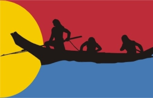
The flag depicts three tribal members in a traditional Clatsop canoe,
harpoon at the ready, all in black, on a background of red over blue.
They approach a yellow half-disk at the flag’s hoist.
A small Indian tribe living in northwestern part of Oregon, by the mouth of Columbia River.
Today, approximately 200 members.
See:
Wk. 49, 12/07/1805 – Fort Clatsop
Wk. 12, 03/22/1806 – Fort Clatsop
![]()
Klamath
Kalamath tribes Great Seal
Image: U.S. ©, Fair Use
(Kalamath/Modoc Resevation in OR)
Population estimate (1700)
Tribe alone: 400 to 1,000
Population estimate (1930)
2,133 (on the res.)
Today’s Population estimate (2024)
Kalamath & Modoc: 5,700 (on the res.)
see:
Modoc – In California Indian Tribes – above
![]()
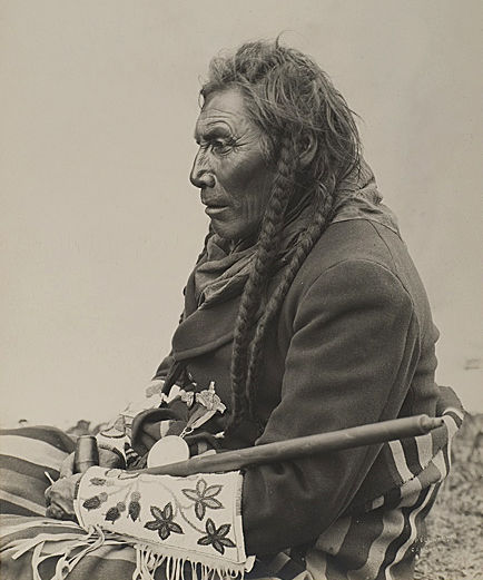
Klickitatat
Kickitat-profile
Photo: U.S. PD – Edward Curtis
Today’s Population estimate (2024)
Tribe alone:
Tribe alone or in any combination:
see:
Wk. 23, 06/09/1855 – Treaty of Yakama
![]()
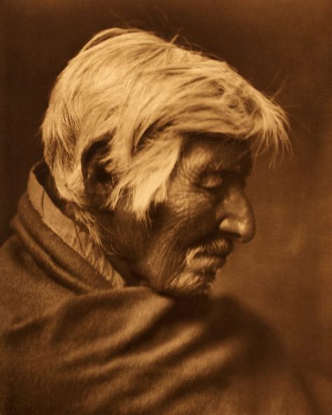
Nez Perce
Nimiipu or Nee-mee-poo –The People
“Pierced Nose” (from the French of first contact)
![]()
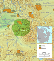 Prior to contact with Europeans, traditional hunting and fishing areas/ancestral Lands: spanned from the Cascade Range in the west to the Bitterroot Mountains in the east. Central Idaho – southeastern Washington – northeastern Oregon centered on the Salmon and Snake rivers.
Primarily semi-nomadic hunter gatherers,
fishermen and hunters.
First Contact: 09/20/1805 – Lewis & Clark in Idaho.
Active modern tribe: Nez Perce Reservations at Lapwai, ID and Colville. Concerned with fishing rights, tribal history and preservation of the language.
Today’s Population estimate (2024)
Tribe alone: 3,500
see:
in this order: Wks. 09, 48, 32, 20
use Control +F ( find), search for:
Nez Perce on the linked pages.
Wk. 28, 06/15/1877 – Nez Perce
Wk. 32, 08/09/1877 – Battle of Big Hole
![]()
Paiute
Big Pine Piaute Great Seal
© Big Pine Piaute Tribe – Fair Use
Big Pine Paiute – Owens Valley
Originally a subsistence culture of foraging [roots such as Cyperus esculentus*], with the addition of fish, pine nuts and wild game.
Origin Tribe of the Ghost Dance** (c. 1889).
Typhoid killed about 10% of the tribe (1867). {001}
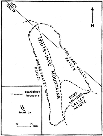
Piaute Tribal area map
U.S. PD? internet
Today’s Population estimate (2024)
Tribe alone: 800
Paiute Indians in Nevada
by Timothy O’Sullivan
see:
* The Originals Index – Resources and Hazards – Food Plants – Nutsedge
** Wk. 01, 01/01/1889 – Ghost Dance
Wk 38, 09/20/1932 – Wovoka, aka: Jack Wilson – Medicine Man
![]()
Shasta
see:
Shasta – In California Indian Tribes – above
![]()
Tillamook
![]()
Umatilla
Umatilla Confederation Flag
Image: U.S. ©, Fair Use
Today’s Population estimate (2024)
Tribe alone: 2,800
see:
Wk. 23, 06/09/1855 – Treaty of Yakama
![]()
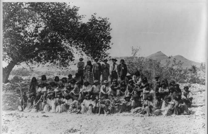
Walla Walla
Walla Walla Tribe
Three Walla Walla Indians
Photo: Edward S. Curtis
A hunter-gatherer tribe. They lived in “tents,” called a longhouse. Constructed from lodge poles, similar to a tipi, but much larger (sometimes as much as 80 feet in length) and covered with tule mats instead of buffalo hides. When relocating they moved the mats but not the frame.
Current population est. 2,800
see:
Wk. 23, 06/09/1855 – Treaty of Yakama
*
![]()
End: Oregon Indian Tribes
Washington Indian Tribes
* at the bottom of a listing = No seal.
Washington Coastal Indians, listed from north to south.
![]()
Kallam
(most northern)
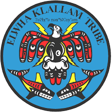
Lower Elwha Klallam Tribe Seal – Image: U.S.©, Fair Use
Klallam refers to four related indigenous Native American / First Nations communities
from the Pacific Northwest of North America.
The Klallam culture is classified ethnographically and linguistically in the Coast Salish subgroup.
Today’s Population estimate (2024)
Tribe alone: 1,400
![]()
Makan
Neah Bay, WA
Today’s Population estimate (2024)
Tribe alone:
Tribe alone or in any combination:
![]()
Quileute
Quileute Tribal Council logo
Image: U.S. ©, Fair Use
Located in La Push, Washington, on the shores of the Pacific Ocean.
The Quileute Tribe has lived and hunted in this area for thousands of years.
Although the village of La Push is only about one square mile,
the Tribe’s original territory stretched along the shores of the Pacific
from the glaciers of Mount Olympus to the rivers of the rain forests.
The Quileute people were forced onto the Quileute Indian Reservation after signing the Quinault Treaty in 1855.
Today’s Population estimate (2024)
Tribe alone:
Tribe alone or in any combination:
![]()
Hoh
Hoh Tribal Seal
U.S. ©, Fair Use
Today’s Population estimate (2024)
Tribe alone:
Tribe alone or in any combination:
![]()
Skokomish
*
![]()
Swinomish Indian Tribal Community
Indigenous people of the Pacific Northwest
including the Central and Coast Salish peoples,
Swinomish, Lower Skagit, Upper Skagit, Kikiallus, and Samish peoples,
who lived in the Samish and Skagit River valleys nearby coasts, and islands.
The Swinomish Reservation is located on Puget Sound, on the southeastern side of Fidalgo Island
in Skagit County, Washington. It was established in 1855 by the Treaty of Point Elliot.
![]()
Quinalt
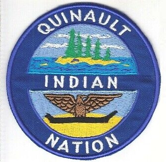
Quinault Indian Nation
Image: U.S. ©, Fair Use
Today’s Population estimate (2024)
Tribe alone:
Tribe alone or in any combination:
![]()
Chehalls
The Swinomish Reservation is located on Puget Sound, on the southeastern side of Fidalgo Island
in Skagit County, Washington. It was established in 1855 by the Treaty of Point Elliot.
Today’s Population estimate (2024)
Tribe alone:
Tribe alone or in any combination:
![]()
Chinook
Chinook Indian Art
Image: U.S. ©, Fair Use
(most southern)
Today’s Population estimate (2024)
Tribe alone:
Tribe alone or in any combination:
![]()
Washington Indians on the East side of Puget Sound, listed from north to south.
![]()
Samish
Samish Indian Nation Logo
Image: U.S. ©, Fair Use
(northern most)
![]()
Skagit
Upper Skagit Indian Tribe logo
Image: U.S. ©, Fair Use
Today’s Population estimate (2024)
Tribe alone:
Tribe alone or in any combination:
![]()
Snohomish
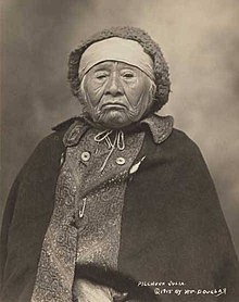
A Snohomish woman
Pilchuck Julia – c-1915
Photo: U.S. PD? internet
A Coast Salish people
Reside around the Snohomish River and northern Puget Sound.
Indigenous to the Puget Sound area of Washington
Today’s Population estimate (2024) (All Salish?)
Tribe alone: 14,850
Tribe alone or in any combination: 24,206
![]()
Squaxin Tribal logo
Image: U.S. ©, Fair Use
Squaxin
(southern most)
Today’s Population estimate (2024)
Tribe alone:
Tribe alone or in any combination:
![]()
Other Washington Indians
![]()
Duwamish
The River People
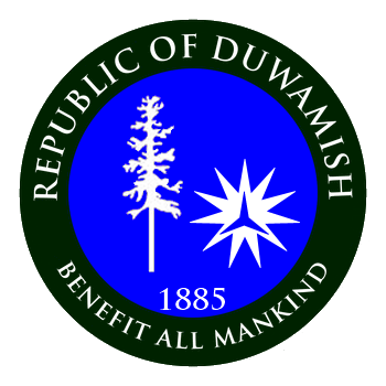
Duwamish Tribal Seal
Image: U.S. ©, Fair Use
Today’s Population estimate (2024)
Tribe alone: 600
see:
Wk.22, 05/31/1896 – Princess Angelina
![]()
Nespelem
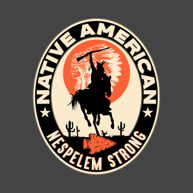
Nespelem Strong patch<br.Image: U.S. ©, Fair Use
Northeastern WA.
Today’s Population estimate (2024)
Tribe alone:
Tribe alone or in any combination:
![]()
Coastal Salish
Southeastern WA.
 Coast Salish Totem Pole
Photo: U.S. PD? internet
The Coast Salish are a group of ethnically and linguistically related Indigenous peoples who inhabit the Pacific Northwest Coast. Their traditional territories span across the U.S. states of Washington and Oregon and the Canadian province of British Columbia.
Woolly Dog
Photo: U.S. PD? internet
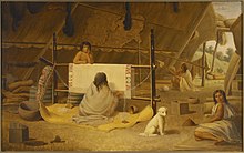
Salish Woman
weaving a blanket
FYI: Woolly Dogs
Coast Salish tribal nations in Washington state and British Columbia had raised and nurtured woolly dogs for millennia. Known for their thick undercoats, these dogs were meticulously cared for, sheared like sheep, and kept in managed environments to ensure their breeding and well-being. The wool from these dogs was woven into blankets and ceremonial items by Coast Salish weavers, playing a vital role in their society’s spiritual and ceremonial aspects. By the mid-19th century, the weaving tradition with woolly dog hair declined.
This now-extinct canine breed held cultural significance for Indigenous Coast Salish communities in the Pacific Northwest for thousands of years. Despite the disappearance of woolly dogs, their memory endures in Coast Salish society.
![]()
Interior Salish
Interior Salish patch
Image: U.S. ©, Fair Use
Southeastern WA.
Today’s Population estimate (2024)
Tribe alone:
Tribe alone or in any combination:
![]()
Cowlitz
A tribe of Southwestern Coast Salish and Sahaptan.
Southwest central WA.
*
![]()
Spokane
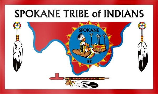
Spokane Tribe of Indians logo
Image: U.S. ©, Fair Use
Their ancestors inhabited much of northeastern Washington which consisted of approximately 3 million acres.
At times they extended their hunting, fishing, and gathering grounds into Idaho and Montana.
Today’s Population estimate (2024)
Tribe alone:
Tribe alone or in any combination:
![]()
Tulalip Tribes
A modern confederation and successor-in-interest of several groups:
the Snohomish, the Skykomish and the Snoqualmie.
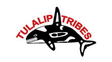
Today’s Population estimate (2024)
Tribe alone:
Tribe alone or in any combination:
End: Washington Indian Tribes
Great Basin Indian Tribes
* at the bottom of a listing = No seal.
![]()
Bannock
Shoshone – Bannock Tribal Seal
Image: U.S. ©, fair use
Today’s Population estimate (2024) Bannock/Shoshone Reservation
Tribe alone: 5,313
see:
Wk. 36, 09/09/1860)
![]()
Paiute
Big Pine Piaute Great Seal
© Big Pine Piaute Tribe – Fair Use
Big Pine Paiute – Owens Valley
Originally a subsistence culture of foraging [roots such as Cyperus esculentus*], with the addition of fish, pine nuts and wild game.
Origin Tribe of the Ghost Dance** (c. 1889).
Typhoid killed about 10% of the tribe (1867). {001}
Piaute Tribal area map
U.S. PD? internet
Today’s Population estimate (2024)
Tribe alone: 12,966
Tribe alone or in any combination: 19,832
see:
* The Originals Index – Resources and Hazards – Food Plants – Nutsedge
** Wk. 01, 01/01/1889 – Ghost Dance
Wk 38, 09/20/1932 – Wovoka, aka: Jack Wilson – Medicine Man
![]()
Shoshone
Eastern Shoshone: Northern Colorado, Montana and Western Wyoming. Hunter gatherers
+ horse, (1600’s) nomadic hunters of buffalo and pronghorn.
Northern Shoshone: Northern Utah and southeastern Idaho.
Fishermen, gatherers > horse in 1600’s, became nomadic plains hunters, buffalo, etc.
Western Shoshone: Eastern California, central and eastern Nevada and northwestern Utah.
Foragers, hunter gatherers.
Ely Shoshone *
Duckwater Shoshone *
Goshute: western Utah, eastern Nevada
Confederated Tribes of the Goshute *
Total Population – around 12,300 (2000)
They traditionally speak the Shoshoni language,
part of the Numic languages branch of the large Uto-Aztecan language family.
Religion:
Christianity
Ghost Dance
Native American Church
Sun Dance
Traditional tribal religion
The Shoshone were sometimes called the Snake Indians by neighboring tribes and early American explorers.
1750’s pushed S & SW by conflicts with the Arapaho, Blackfoot, Cheyenne, Crow and Lakota;
some then became the Comanche** of the southwest. Also: Timbisha
They were heavily involved in the Snake War (1864-68).
Today’s Population estimate (2024)
Tribe alone: 10,802
Tribe alone or in any combination: 18,501
see:
References – Dictionary – Snake Indians, Snake War
Wk 14, 04/07/1805 – Sacajawea
Wk. 38, 08/20/1864 – Ward Massacre
Wk. 36, 09/09/1860 – Otter Wagon Train attack
** Comanche – below
* The Originals Index – Battlefields and Massacres –
Massacres of Indians – The Bahsahwahbee Massacre
Shoshone Indians
Photo: U.S. PD, pre-1923
![]()
Ute
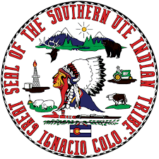 Great Seal of the Southern Ute
Nuche
high up or land of the sun
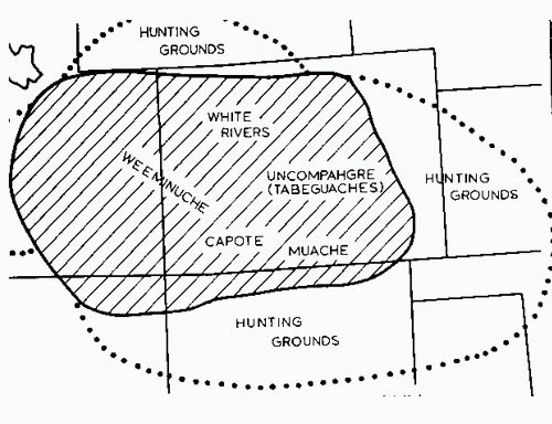
Tribal Divisions:
Capote
Mouache [Southern Utes]
Tabeguache [Uncompahgre] (current census 2,790 [2015])
Winimunche (Weemunuchee) [Western]
Today:
The Ute have a very active Modern Tribal culture holding annual Bear Dances, Sun Dances and other gatherings.
Northern Ute Reservation – Fort Duchesne, UT: White River (2nd largest in U.S.)
Southern Ute Reservation – Ignacio, CO: Capote, Mouache & Tabeguache
Ute Mountain Reservation – Towaoc, CO: Winimuche -Ute Mountain Tribal Park
 First mention by Spanish chroniclers 1626, then by Fray Francisco de Escalante in 1776.
Ancestral Lands: centered in Colorado but also parts of New Mexico, Utah and Wyoming.
Traditionally nomadic hunter-gatherers, particularly in the western more desert-like part of their territory. The eastern mountainous areas provided more variety in plants and larger more plentiful game, if a colder climate.
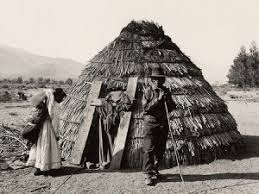
The Spanish invasion into the Southwest from Mexico began c. 1530’s. Likely first contact with Europeans was late 1500’s with horses being acquired late 1600’s via trade with Pueblo Indians to the south. First Treaty with the Spaniards 1670. As with most tribes, the mobility of the horse led to lifestyles similar to those of the plains Indians. They became very successful nomadic mountain buffalo hunter gatherers, raiders, slavers and traders. They raided Spanish settlements, warred occasionally with the Arapahoe and resisted any incursion into their lands by the whites. Including to some extent, the Mountain Men. The Mormon invasion of Utah beginning in 1847 led to major conflicts. The Walker War of 1853 and The Black Hawk War of the 1860’s. But it was to be mining and the theft of their lands that brought the oncoming white culture into the final conflict with the Utethat and an over zealous missionary . All resulting in the Ute being forced onto reservations in Utah and Colorado by the Army 1879 & 1881.
{001 & 021}
Today’s Population estimate (2024)
Tribe alone: 9,486
Tribe alone or in any combination: 14,958
Further Reference to Ute Indians:
Players – Timelines Index – Timelines M-Z Index – Ute Indians Timeline
Photo Gallery Index – Indian Photos – Chief Ouray & Chipeta
–Pine River Store; Sapiah (aka: “Buckskin Charley”)
–Chief Ouray‘s Re-internment 1925)
Map: Ute Lands c. 1492 borrowed from the Ute Tribal Website (see: References – Websites)
The Originals Index – Landmarks and Registers – Sleeping Ute
see:
Quotes Index – Indian Quotes – Gov. F.W. Pitkin)
Wk 15, 04/10/1865 – Black Hawk’s War (western)
(Wk. 39, 09/29/1879 – Meeker Massacre
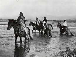
Southern Ute Indians
Photo: US PD, pre-1923
End: Great Basin Indian Tribes
Plains Indian Tribes
* at the bottom of a listing = No seal.
![]()
Arapaho
 Inuna-ina
our people
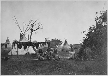
Arapaho camp – Ft. Dodge, KS – 1870
drying buffalo meat
(1600’s), Minnesota & North Dakota > Montana > Wyoming and Colorado. Migratory hunters > + horse (1700’s), buffalo hunters, raiders.
Self divided in 1832 with some influence by William Bent*.
Northern Arapaho – Wyoming, North Platte River. Nomadic buffalo hunters, raiders.
Southern Arapaho – Colorado, Arkansas River. Nomadic Buffalo hunters, raiders.
Today’s Population estimate (2024)
Tribe alone: 8,449
Tribe alone or in any combination: 12,364
Photo: U.S. PD? – internet
see:
Wk. 20, 05/19/1869)
Wk. 34, 08/21/1849)
![]()
Assiniboine
aka: Nakota, Hohe,
Assiniboine and Grosventre Tribal Flag
Iron Confederacy
This tribe who live to the North of most of the Sioux peoples were the first of the Siouan-speaking peoples to leave the Eastern Woodlands and move onto the Great Plains. Speaking a Siouan language closely related to the Sioux language but are not considered part of the modern Oceti Sakowin. They had separated as a separate people sometime before 1640, when they were first documented as a tribe by French missionaries. Other Sioux-speakers referred to them as the Hohe, (rebels). The Canadian Nakoda (Stoney) possibly began as the westernmost band of the Assiniboine but were referred to as a separate people after about 1744. Later, in the nineteenth century, further bands belonging to the Dakota peoples and to a lesser extent to the Lakota, also moved to Canada and their descendants still live in several of the Canadian First Nations.
The tribe became a member of the Iron Confederation with the Cree. (c. 1840’s).
Through the Confederation, they became reliable and important trading partners and middlemen, in the vast area known then as Rupert’s Land in western Canada, for Hudson’s Bay Company and the Northwest Company. Later, during the later 18th century and early 19th century, south of the border in what became Montana and the Dakota territories, the tribe traded with the American Fur Company and the competing Rocky Mountain Fur Company. The trade was for guns, gunpowder, metal tomahawks, metal pots, wool blankets, wool coats, wool leggings, and glass beads and other goods in exchange for beaver pelts, bison robes and other furs.
Increased contact with Europeans resulted in Native Americans contracting endemic Eurasian infectious diseases, most notably smallpox. The tribe suffered epidemics with high mortality and the population crashed from around 10,000 people in the late 18th century to around 2600 by 1890.
.png)
Assiniboine 1851 treaty territory
Photo: U.S. PD, pre-1923
Tribe alone: 7,000
The Sioux Nation -below
The Originals Index – Expeditions – The Fur Trade – The Iron Confederacy
or References – Dictionary – Iron Confederacy
The Originals Index – The Pemmican Trade
Just for Fun Pages – Monsters and Supernatural Beings of the Old West – Assiniboine Creation Myth
Photo Gallery Index – Indian Photos – Assiniboine Buffalo Robe –
(5th photo from the bottom of the page)
![]()
Blackfeet
Ampskapi Piikani (US)
Blackfeet Tribal Seal
U.S. ©. fair use
Blackfeet: Siksika {Blackfoot – those with black-dyed mocasins} (north)
Blood: Kainai, Kainah {blood} (middle)
Piegan: Piikáni, Pigunni {poorly dressed} (south)
An Algonquian people of the North American Great Plains. Eastern U.S. > North Dakota, Wyoming and Montana. Migratory plains hunter gatherers from the east until acquiring the horse in the 1700’s then, primarily buffalo hunters and Raiders. Raised tobacco. Notably defensive of territory
Largest of three Blackfoot-speaking groups that made up the Blackfoot Confederacy.
Piegan peoples in Canada and the United States were forced to divide their traditional homelands in the nineteenth century according to the national borders . They were forced to sign treaties with one of those two countries, settle in reservations on one side or the other of the border, and be enrolled in one of two government-like bodies sanctioned by these two North American nation-states. The two successor groups are the Blackfeet Nation a “federally recognized tribe” in Montana, USA and the Piikani Nation, a recognized “Indian band” in Alberta, Canada.
The Blackfeet are fairly recent occupiers of this area. Until 1600 CE, they resided in an area of the woodlands north and west of the Great Lakes. Pressure exerted by British traders at James Bay in present day Canada on the Algonquin-speaking tribes in the area drove the Blackfeet out onto the Northern Plains. They eventually acquired firearms and horses and became a formidable example of the classic Plains Indian culture. They were a powerful force, controlling an area that extended from current day Edmonton, Alberta Province, nearly to Yellowstone Park, and from Glacier Park to the Black Hills of South Dakota. Their sacred history became centered in the Badger-Two Medicine area, known as their “Cathedral”.
In the late 19th century, Blackfeet territory was encroached on by European Americans and Canadians, and various branches of the people were forced to cede lands and ultimately move to smaller Indian reservations in the United States and reserves in Canada.[4] Adjacent to their reservation, established by Treaty of 1896, are two federally controlled areas: the Lewis and Clark National Forest, set up in 1896, which contains the Badger-Two Medicine area, an area of 200 square miles (130,000-acres); and Glacier National Park, both part of the tribal nation’s former territory. {001}
see also:
The Originals Index – Landmarks and Registers – Sweetgrass Hills
Just for Fun Pages – Monsters and Supernatural Beings – The Sweetgrass Hills
References – Dictionary – Wolfers
Today’s Population estimate (2024)
Tribe alone: 29,575
Tribe alone or in any combination: 159,394
![]()
Cheyenne
Tstchestahase
beautiful people
(1680), Minnesota > Conflict migrations: North & South Dakota >Nebraska/Wyoming. Originally farmers/hunter gatherers > (+ horse 1700’s) nomadic buffalo hunters;
self-divided around 1832:
Northern Cheyenne – Nebraska/Wyoming. Nomadic Buffalo hunters, raiders.
Southern Cheyenne – Kansas and Colorado. Nomadic Buffalo hunters, raiders.
– Influenced by William Bent to move near his trading fort on the Arkansas River in Colorado. {019}
The Warrior Societies
Along with the Council of Forty-four, Cheyenne military societies were one of the two central institutions of traditional Cheyenne Indian tribal governance. Council chiefs were responsible for overall governance of individual bands and the tribe as a whole. The chiefs or headmen of military societies were in charge of maintaining discipline within the tribe, overseeing tribal hunts and ceremonies, and providing military leadership. Council chiefs selected which of the six military societies would assume these duties; after a period of time on-duty, the chiefs would select a different society to take up the duties.
The Four Original Societies
Originally established by the prophet Sweet Medicine,
these four societies were the original Cheyenne military societies.
Over time, some have transformed or developed branches.
Fox
Fox Warriors Society (Vóhkêséhetaneo’o or Monêsóonetaneo’o), also known as Swift Fox or Kitfox.
This society is found among both the Northern and the Southern Cheyenne.
The Coyote Warriors Society (O’ôhoménotâxeo’o) and Flintmen Society
(Motsêsóonetaneo’o) are branches of the Fox Warriors Society.
Elk
Elk Warriors Society (Vóhkêséhetaneo’o or Monêsóo)
also known as Elk Horn Scrapers, Bone Scraper Society, Hoof Rattle,
Crooked Lance, Headed Lance or Medicine Lance.
This society is found among both the Northern and the Southern Cheyenne.
This was the society of the mixed-blood Cheyenne George Bent
and the famous warrior Roman Nose.
Shield
Shield Warriors Society (Ma’êhoohevaso) also known as Red Shield.
This society was originally found in both the Northern and the Southern Cheyenne,
but today is found only among the Northern Cheyenne. Buffalo Warriors (Hotóanótâxeo’o),
also known as Buffalo Bull or Bull, is a branch of the Shield Warriors Society.
Bowstring
Bowstring Men (Héma’tanóohese), also known as the Owl Man’s Bowstring.
This society was originally found in both the Northern and the Southern Cheyenne.
Today, it is found only among the Southern Cheyenne.
Wolf Warriors Society (Ho’néhenótâxeo’o),
this is the alternate name for the Bowstring Men among the Southern Cheyenne.
This society developed out of the Bowstring Men in the 19th Century by a vision held by Owl Friend.
More modern additions…
Fifth society
Dog Warrior Society (Hotamétaneo’o), also known as Dog Men.
This society was also called Dog Soldiers by the whites.
The Dog Warrior Society was established by a directive given in a visionary dream after the prophet Sweet Medicine’s departure.
This society was originally found in both the Northern and the Southern Cheyenne,
but today is found only among the Southern Cheyenne.
Crazy Dogs (Hotamémâsêhao’o), also known as Foolish Dogs.
This society is similar to the Bowstring Men in function but found only among the Northern Cheyenne.
Among the Northern Cheyenne, Dog Warrior Society and Wolf Warriors merged,
which resulted in the development of the new breed of Dog Warriors now called the Crazy Dogs.
The Crazy Dogs are considered by many to be a sixth society instead of a branch of the fifth society.
Sixth society
Contrary Warriors Society (Hohnóhkao’o) also known as the Inverted Bow-string Society.
Its members, the Contrary Warriors, have proved in bravery by riding backward into battle.
Contrary Society, also known as Clown Society
This society draws upon the same spiritual powers as the Contrary Warriors Society,
it was primarily composed of Cheyenne elders and may be a mature variation of the Contrary Warriors Society.
They were charged with educating the Cheyenne ceremonial ways of the cultural “dos” and “don’ts”
through humor, sarcasm and satire, in a fashion that is contrary to the normalcy of traditional Cheyenne culture.
Today’s Population estimate (2024)
Tribe alone: 11,171
Tribe alone or in any combination: 21,728
see:
PLAYERS – Timelines – Timelines A-L – Cheyenne Indians Timeline)
Chippewa Cree
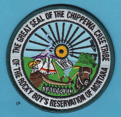
Rocky Boy Reservation – Montana
Today’s Population estimate (2024)
Tribe alone: 119,729
Tribe alone or in any combination: 214,026
![]()
Comanche
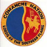 Nʉmʉnʉʉ
The People
The Comanche Nation were once a part of the Shoshone Tribe. In the late 1600’s and early 1700’s, they migrated across the plains, through Wyoming, Nebraska, Colorado, Kansas, New Mexico, Texas, and Oklahoma, ultimately settling in Southwest Oklahoma. There was no Chief who had central authority over the entire tribe. Comanche Bands were formed on the basis of kinship and other social relationships. Membership was not static. There were a number of reasons one might change bands, marriage, or to go on a raid with another band, etc. Each band had two chiefs: a Peace Chief (Civil Chief) and a War Chief. The Peace Chief determined when and where the tribe would move and acted within a council as a decision-making body for resolving disputes and crimes among the band. The War Chief was, most often a well-recognized, exceptional warrior. The title was mostly advisory, an honorific, he did not suggest targets, choose the participating warriors or lead the war parties (except those of his own making). The Peace Chief was usually superior. Leadership was based solely on merit and the strength of their following. They had no authority outside of their own band.
Historians generally agree that there were five major bands at the turn of the 18th century.
They were:
Yamparika (Yap Eaters)
The northernmost band, inhabiting lands south of the Arkansas River
see:
Wk. ?? – Bents Old Fort
Kotsoteka (Buffalo Eaters)
Inhabiting the Canadian River Valley in what would become Oklahoma and the Texas Panhandle
Penateka (Honey Eaters)
The Southernmost Band, inhabiting most of central and southern Texas.
see:
Wk. 31, 08/01/1840 – Great Raid of 1840
Nokoni (Wanderers)
The “middle” Comanches, inhabiting north Texas and Oklahoma
between the Penateka and the northern bands.
Quahadis (Antelopes)
Inhabited the area of the headstreams of the Colorado, Brazos and Red Rivers.
see:
Wk. 08, 02/22/1911 – Quanah Parker
All of the bands had at least 1,000 members, the Penateka was once estimated at 5,000 or more. The entire tribe may have reached 20,000 members at its peak. It was barely over 1,000 after the Red River War (1872 – 74)
No doubt, other bands came and went; became casualties of raids or war, etc.
Lifestyle: Nomadic Raiders, Traders, Buffalo Hunters
The buffalo was an important resource, providing food, clothing, tepee covering, and a wide variety of other goods.
This tribe was highly skilled at breeding and trading horses, a key element in Comanche culture. Fighting battles on horseback, with skill beyond other Indian peoples of the time, led to a tremendous advantage in times of war. Comanche horsemen set the pattern of nomadic equestrian life that became characteristic of the Plains tribes in the 18th and 19th centuries.
Today’s Population estimate (2024)
Tribe alone: 12,268
Tribe alone or in any combination: 29,325
see:
PLAYERS – Timelines – Timelines A-L – Comanche Indians Timeline)
Shoshone – above
![]()
Muscogee Nations
Creek Confederacy
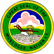
Creek Muscogee Nation Seal Image: U.S. ©, Fair Use
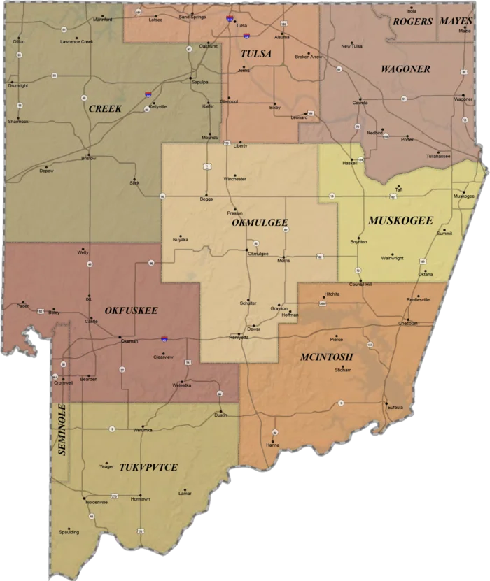
Creek Nations Map
Oklahoma
U.S. PD? internet
Creek, Muscogee, Okfuskee, Okmulgee, Poarch and Tukvpvtce Tribes
Today, also enrolled in this nation: Alabama, Koasati, Hitchiti, Natchez, Yuchi. Other federally recognized Muscogee groups include the Alabama-Quassarte Tribal Town, Kialegee Tribal Town, and Thlopthlocco Tribal Town of Oklahoma; the Coushatta Tribe of Louisiana, the Alabama-Coushatta Tribe of Texas.
This very abreviated story of these southeasten peoples forced west is, ‘classic with variations’, for a short look at pertinent events with little more detail than Old West Daily Reader usually provides. Eventually, a companion piece to Dakota War (1862) and the Modoc War (1872-73).
The nation descends from the historic Muscogee Confederacy,
a large group of indigenous peoples of the Southeastern Woodlands,
who lived in six towns in the future to be, Alabama and Georgia,
Cusseta, Coweta, Areka, Coosa, Hoithle Waule, and Tuckabatchee.
In the usual fashion of the times, they lost their ancestral lands
through outright war and criminal machinations of treaties, “land deals”
and such, purpetrated by by the Europeran invaders.
An estimated 3,500 Creeks died in Alabama and on the Trail of Tears.*
Today’s Population estimate (2024)
Tribe alone: 44,041
Tribe alone or in any combination: 108,368
see:
*References – Dictionary – Trail of Tears
Wk. 13, 03/27/1814 – Battle of Horseshoe Bend
Wk. 07, 02/12/1825 –Treaty of Indian Springs
Wk 18, 04/30/1825 – Tustunnuggee Hutke (White Warrior),
aka: William McIntosh
Wk. 22, 05/28/1830 – Indian Removal Act
![]()
![]()
Crow
 – The Absaalooke Nation
“Children of the large-beaked bird”
The original identity of the bird is lost to time,
but many Apsáalooké people
believe it references the mythical Thunderbird.*
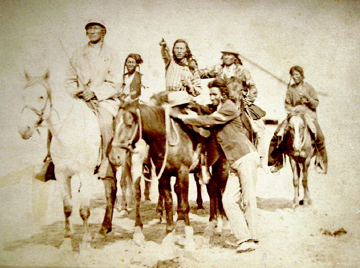
Crow Indians 1878 – 1883
Photo: U.S. PD – David Francis Barry
Ashalaho – Many Lodges’, today called Mountain Crow
Awaxaawaxammilaxpáake – ‘Mountain People’, or Ashkúale ‘The Center Camp’
Binnéessiippeele – ‘Those Who Live Amongst the Riverbanks’
Ashshipíte – today, called River Crow or(‘The Black Lodges’
Eelalapito – Kicked in the Bellies or Ammitaalasshé
Home away from The Center, that is, away from the Ashkúale – “Mountain Crow”
Apsaalooke oral history describes a fourth group, the Bilapiluutche – “Beaver Dries its Fur”
who may have merged with the Kiowa in the second half of the 17th century.
The Ashalaho or Mountain Crow, were the first to travel west, they were the largest Crow group to split from the Awatixa Hidatsa. Crow leader, No Intestines, had received a vision and led his people on a long migratory search for sacred tobacco, finally settling in the foothills and Rocky Mountains along the Upper Yellowstone River (present-day Wyoming-Montana border). This included the Big Horn and Absaroka Range (aka: Absalaga Mountains). The the eastern edge of their territory being the Black Hills.
The Binnéessiippeele, (River Crow) Tradition says they split from the Awatixa Hidatsa due to a dispute over a bison stomach. The Hidatsa called them Gixáa-iccá, “Those Who Pout Over Tripe”. They settled along the Yellowstone and Musselshell rivers south of the Missouri River and in the river valleys of the Big Horn, Powder and Wind rivers (historically known as the Powder River Country), sometimes traveling north to the Milk River.
Eelalapito – (Ammitaalasshé), claimed the area known as the Bighorn Basin, from the Bighorn Mountains in the east to the Absaroka Range to the west, and south to the Wind River Range in northern Wyoming. Occasionally settling in the Owl Creek Mountains, Bridger Mountains and in the south along the Sweetwater River.
By the early 19th century, the Apsáalooke fell into three independent groupings, who came together only for common defense.
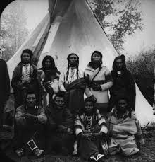
Crow Indians
Photo: U.S. PD, pre-1923
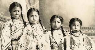
Four unknown Crow Girls
Photo: U.S. PD, pre-1923
Today’s Population estimate (2024)
Tribe alone: 11,812
Tribe alone or in any combination: 18,285
see also:
* Just for Fun Pages – Monsters and Supernatural Beings of the Old West – Thunderbird
Links to Friends – Little Big Horn College
Wk. 01, 01/03/1959 – Dr. Lanny Real Bird
![]()
Gros Ventre
Assiniboine and Grosventre Tribal Flag
U.S. ©, Fair Use
Today’s Population estimate (2024)
Tribe alone: 7,000
![]()
Hidatsa
see also:
Sioux – below
Hidatsa Tribal Seal – Native American Tribes
U.S. .©, Fair Use
Today’s Population estimate (2024)
Tribe alone: 16,986
Wk. 23, 06/05/1957 – Frances Theresa Densmore
![]()
Ioway
Ioway Tribal Seal
Image: ©, Fair Use
Today’s Population estimate (2024)
Tribe alone: 800
![]()
Kaw
Kaw Tribal Seal
Image: ©, Fair Use
Today’s Population estimate (2024)
Tribe alone: 3,100
![]()
Kiowa
Kiowa Tribal Seal
Image: U.S. ©, Fair Use
Kiowa [Kaigwu] {main people} – Modern archaeology shows that the Kiowa are an Athabaskan people who originated in the Kootenay Region of British Columbia, Canada. They split off from the Apache after the migration from Alaska in the late 1400’s or early 1500’s. The tribe migrated to Western Montana (1600’s) > (1700’s) eastern Wyoming, South Dakota > {expansion pressure} Nebraska – North Platte River > Kansas and northern Oklahoma. Nomad hunter gatherers, > + horse (1700’s) Nomadic Plains Hunters – buffalo; Raiders.
Arikara [Arikaree] {horns} (1700’s?) North Dakota > + horse (1700’s) hunted west to Montana. Farmers, village seasonal buffalo hunters. and continued to move until they inhabited present day Nebraska, Kansas, Oklahoma and Texas.
During the horse culture era of the Great Plains, the Kiowa were particularly aggressive. Their incessant raiding made many enemies among other tribes: Arapaho, Cheyenne, Lakota Sioux, Navajo, Pawnee, Osage, Ute, and Wichita, among others.
The Kiowa
Photo: U.S. PD – Wiki
A Kiowa warrior’s shield was a very important statement.
They were made of bison hide stretched over a small, wooden frame,
elaborately adorned with paint, feathers, fur, teeth and claws.
by presenting valuable gifts to the Taime Keeper.
A Kiowa man’s wealth was measured by his herd of horses.
Augmented later by the firearms in his possession.
Eagle Shield Society – perhaps as powerful as the Taime.
Led by the legendary chief Sitting Bear.
A warrior with an Eagle shield was said to be invulnerable in battle.
Said to have been founded by a woman, however, after her, all members had to be men.
Owl Shield Society – They communed with the spirits to foresee the future and answer questions.
Bear Old Woman Society – A women’s society which was thought to be able to harness the power of the bear. Believed to create the most powerful medicine in the tribe. Something to be feared, as the Kiowa considered the bear dangerous and taboo.
The Koitsenko – aka: “Real Dogs“, only ten members.
The ten greatest warriors from the entire tribe, elected by all of the members of each band.
Unmistakable, members wore a black and red sash to denote their status.
Their leader sported a spotted antelope sash.
see also:
Wk. 23, 06/08/1872 – Satank
Rather than to train them for warfare, before they grew up and moved onto different societies,
The Kiowa believed in ghosts and dark spirits which could haunt the land of the living.
End of life rituals were visceral. When someone died,
the Kiowa would burn nearly all of their possessions, including their tipi.
Their family was expected to demonstrate their grief
by wailing, ripping off their clothes, shaving their head and occasionally self-laceration.
Today’s Population estimate (2024)
Tribe alone: 8,196
Tribe alone or in any combination: 14,603
see also:
Wk. 43, 10/24/1862 – Wichita Agency Massacre
Wk. 23, 06/08/1871 – Chief Satank
Wk 41, 10/11/1878 – Chief Satanta
Photo Gallery Index – Indian Photos – Catlin Paintings – Great Chief Dohäson
Yavapai – Apache – below
![]()
Mandan
First contact with Europeans – 1738. French Fur Traders (the La Vérendrye family).
Their native lands ranged across the Missouri River basin extending from present day ND, through western MT and WY.
The Mandan, Hidatsa, and Arikara Nation (MHA Nation)
Aka: Three Affiliated Tribes (Mandan: Miiti Naamni; Hidatsa: Awadi Aguraawi; Arikara: ačitaanu’ táWIt)
The tribe was decimated by the white man’s diseases: cholera, measles, syphilis, smallpox and tuberculosis.
By the middles of the nineteenth century there were less than forty still alive.
Today’s Population estimate (2024)
Tribe alone: 15,986
see:
The Originals Index – Resources and Hazards – Disease
![]()
Métis
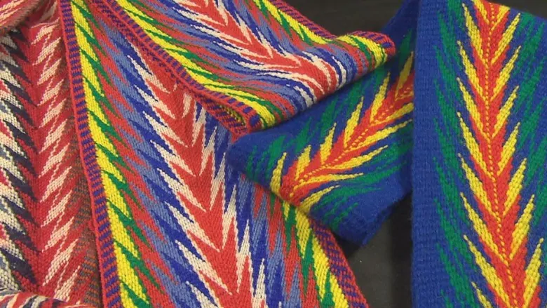
Traditional-metis-sashes (CBC)
Iron Confederacy
The Métis are a multi ancestral Indigenous peoples who share culture, traditions and language with those who trace family roots back to the descendants of Scottish and French Catholic (the majority) fur traders who created a 19th-century settlement called the Red River colony, which was then, located in present-day Manitoba and North Dakota.
Métis (Fr.) is an adjective referring to someone of mixed ancestry. Since the 18th century, the word has been used to describe individuals with mixed Indigenous and European ancestry. However, it is generally recognized that being Métis is far more than having mixed Indigenous and European heritage. The Métis have a distinct collective identity, customs and a way of life, unique from Indigenous or European roots.
Today’s Population estimate (2024)
Tribe alone: 624,220
see:
The Originals Index – The Pemmican Trade
The Originals Index – Expeditions – The Fur Trade – The Iron Confederacy
or References – Dictionary – Iron Confederacy
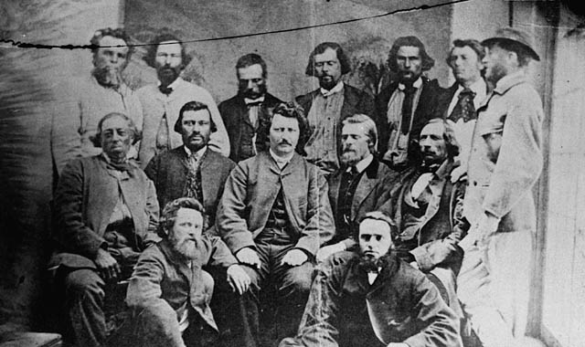
Counselors of the Provisional Métis Government (1870) no available attributes
![]()
Otoe Missouria
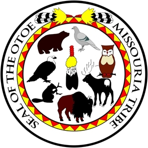
Otoe Missouria Tribal Seal
Image: U.S. ©, Fair Use
Today’s Population estimate (2024)
Tribe alone: 4,665
![]()
Omaha
Those going against the current
Omaha Tribal Seal
Image: U.S. ©, Fair Use
The Omaha tribe began as a larger woodland tribe comprised of both the Omaha and Quapaw.
The original tribe inhabited the area near the Ohio and Wabash rivers, near present-day Cincinnati, Ohio.
As the tribe migrated west it split into what became the Omaha tribe and the Quapaw tribes.
The Omaha Reservation in northeastern Nebraska and western Iowa,
Today’s Population estimate (2024)
Tribe alone: 4,700
![]()
Osage
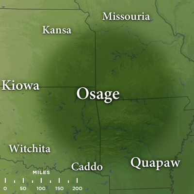
Traditional Osage Tribal Lands map
Late 17th Century
Map: U.S. P.D. 1012, MonsMonstrum
The tribe developed in the Ohio and Mississippi river valleys along with other groups of its language family (around 700 BC).
Today’s Population estimate (2024)
Tribe alone: 9,085
Tribe alone or in any combination: 24,242
see:
The Originals – Battlefields and Massacres – Massacres by Indians – Claremore Mound Massacre
Wk. 43, 10/24/1862 – Wichita Agency Massacre)![]()
Pawnee
![]()
Their self-name is Chatiks si chatiks, which translates as “Men of Men.”
The wolf is the symbol of the Pawnee. They were called “Wolves,” by other Plains tribes
because the wolf is known for courage and cunning.
The Pawnee are a Central Plains Indian tribe that historically lived in villages of earth lodges near the Loup, Republican, and South Platte rivers in Nebraska and northern Kansas. Tribal activities throughout the year alternated between farming crops and hunting buffalo. The Pawnee language belongs to the Caddoan language family.
The Pawnee were divided into two large autonomous groups: the Skidi/Skiri Federation living in the north and the Cawi/Chaui Federation living in the South (divided into several villages). The Cawi/Chaui were generally the leading political group even though the Skidi/Skiri-Federation were the most populous. Each band generally saw to its own. However, in response to pressures from the French, the Spanish, the Americans, and neighboring tribes, it became necessary for the Pawnee to draw ever closer together.
Today, they are federally recognized as the Pawnee Nation of Oklahoma, based in Pawnee, OK. {001}
Today’s Population estimate (2024)
Tribe alone: 3,200
see:
References – Dictionary – panis
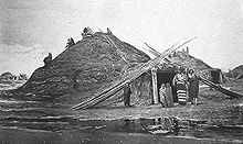
Pawnee-lodge -c-1873
Photo: U.S. PD internet
FYI: My adoptive mother was a quarter Pawnee, her Grandfather, was the full blood. – Doc
![]()
Ponca
Ponca Tribe Great Seal
U.S. ©, Fair Use
Today’s Population estimate (2024)
Tribe alone: 2,783
![]()
QuaPaw
Quapaw Seal>br>Image: U.S. ©, Fair Use
Native Americans that coalesced in what is known as the Midwest and Ohio Valley.
The Dhegiha Siouan-speaking tribe historically migrated from the Ohio Valley area to the west side of the Mississippi River
in what is now the state of Arkansas; their name for themselves refers to this migration and to traveling downriver.
Oklahoma
Today’s Population estimate (2024)
Tribe alone: 5,600
![]()
Sarcee
Sarcee Chief Big Belly>br>Image: U.S. © Fair Use
Today’s Population estimate (2024)
Tribe alone: 2,439 (Canada)
![]()
The Sioux Nation
Oceti Sakowin
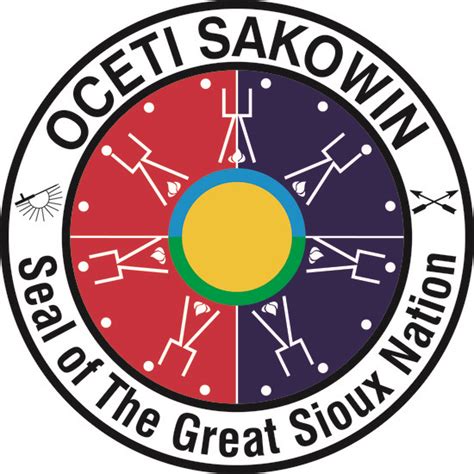
Sioux Nation Great Seal
Image: U.S. ©, Fair Use
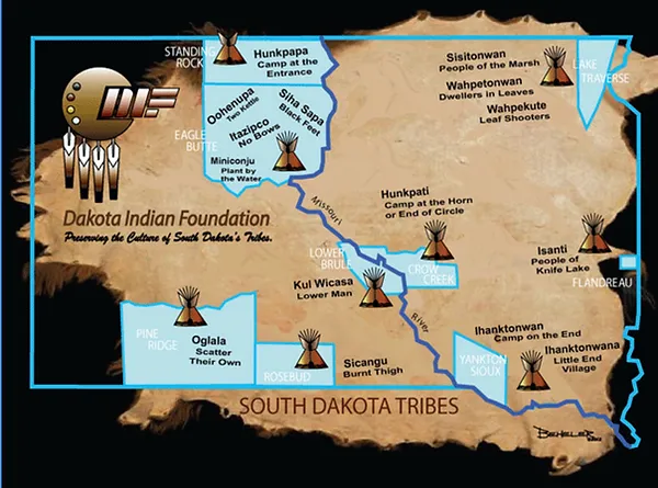
South Dakota Tribes location map
courtesy Dakota Indian Foundation
The Great Sioux Nation is divided into three linguistically
and regionally based groups and several subgroups.
Linguistically, all three language groups belong to the Sioux language.
Lakota
OWDR Oglala Lakota
logo – Fair Use
Also known as Lakȟóta, Thítȟuŋwaŋ, Teton, and Teton Sioux
Northern Lakota (Húŋkpapȟa, Sihásapa)
Central Lakota (Mnikȟówožu, Itázipčho, Oóhenuŋpa)
Southern Lakota (Oglála, Sičháŋǧu)
Sioux [Dakota, Lakota, Nakota] {allies} (early 1600’s), most of Minnesota and parts of Iowa, North and South Dakota and Wisconsin > Conflict migration: North and South Dakota, west as far as eastern Wyoming and Montana. Originally woodland hunter gatherers > + horse around 1740’s in the west west: nomadic buffalo hunters/ 1700’s east: farmers, village-based buffalo hunters.
see:
The Originals Index – Dakota War – 1862
Today’s Population estimate (2024)
Tribe alone: 43,146
Western Dakota
Also known as Yankton-Yanktonai or Dakȟóta
Yankton (Iháŋktȟuŋwaŋ)
Yanktonai (Iháŋktȟuŋwaŋna)
The total population of all Dakota, Lakota, and Nakota people living in the U.S.
100,000 of these people in the U.S. and 10,000 in Canada
Eastern Dakota
Santee Sioux Nation logo
Logo © Santee Sioux Nation
Fair Use
Also known as Santee-Sisseton or Dakhóta
Santee (Isáŋyáthi: Bdewákhathuŋwaŋ, Waȟpékhute)
Sisseton (Sisíthuŋwaŋ, Waȟpéthuŋwaŋ)
Santee [Dakota] (Eastern Sioux): Minnesota along the Minnesota River. Woodland fishermen, hunter gatherers.
– Sisseton; Wahpeton; Wahpekute and Mdewakanton
____________________________________________
Standing Rock Sioux Tribe: enrolled membership about 16,000
The total population on the reservation is over 8,000 people
Pine Ridge Indian Reservation: roughly 40,000 members
Sioux [Dakota, Lakota, Nakota] {allies} (early 1600’s), most of Minnesota and parts of Iowa, North and South Dakota and Wisconsin > Conflict migration: North and South Dakota, west as far as eastern Wyoming and Montana. Originally woodland hunter gatherers > + horse around 1740’s in the west west: nomadic buffalo hunters/ 1700’s east: farmers, village-based buffalo hunters.
see:
The Originals Index – Dakota War – 1862
Hidatsa are enrolled in the federally recognized Three Affiliated Tribes of the Fort Berthold Reservation in North Dakota. Their language is related to that of the Crow, and they are sometimes considered a parent tribe to the modern Crow in MT.
see:
Wk. 23, 06/05/1957 – Frances Theresa Densmore
Teton [Titonwan] [Lakota] (Western Sioux): western South Dakota (Black Hills) and eastern Wyoming and eastern Montana. Nomadic buffalo hunters.
Brulé [Sicangu]; Hunkpapa; Itazipco; Miniconjou (“They who plant by the water“); Oglala; Oohenonpa [Two Kettle]; Itazipco [Sans Arcs]; Sihasapa
see:
Players – Timelines Index – Timelines A-L Index – Indian Treaties Timeline & Indian Wars Timeline)
Yankton [Ihanktonwan] (Nakota): (Middle Sioux): southeastern South Dakota and southwestern Minnesota along the Missouri River. Woodland fishermen, hunter gatherers.
Yanktonai [Nakota] (Middle Sioux) eastern North and South Dakota along the Missouri River. Woodland fishermen, hunter gatherers.
Standing Rock Sioux Tribe: enrolled membership about 16,000
The total population on the reservation is over 8,000 people
Pine Ridge Indian Reservation: roughly 40,000 members
Yanktonai; Hunkpatina and…
Assiniboine {those who cook with stones} Northern Minnesota and southwestern Ontario broke away from other Sioux to Canada in the 1600’s, then to Montana and North Dakota. Nomadic buffalo hunters.
see:
Assiniboine – above
Today’s Population estimate (2024)
Tribe alone or in any combination: 207,684
see also:
PLAYERS – Timelines Master Index – Timelines A-L Index – Indian Treaties Timeline
PLAYERS – Timelines Master Index – Timelines A-L Index – Indian Wars Timeline
The Originals Index – Dakota War – 1862
see also:
Wk. 23, 06/05/1957 – Frances Theresa Densmore
Links to Friends – Oglala Lakota College
FYI: I have included more information on the Sioux than the other tribes for several reasons:
First, I wanted to offer a small look at the complexity of infra-tribal relations, and the Sioux, were and are, a big, diverse tribe with a wide variety of territories and lifestyles; many of which were forced to change with the times.
Second: They tend to be seen as the iconic Western Indian of the Plains Indian Wars; just as the Apache and Comanche were an icons in their own right in the southwest. Although the names of Sioux warriors and the names of their bands loom large in the history of the Plains Wars; truth is, not all the Sioux were involved in the wars, because contingents of the tribe were well east of the conflicts of those times. Many had nothing to do with Custer and they were not involved in the catastrophe at Wounded Knee. The Sioux, as a group, were large enough to have experienced the full spectrum of the white invasion for good or ill and so, mirror and example the fate of all. As with other tribes, they still struggle with the government yet today.
Third: Information is readily available about the Sioux, partly because of all of the above.
Tribal members or others with knowledge of the subject, please feel free to offer suggestions or corrections. I want the information here to be accurate. – Doc
![]()
Otoe Missouria
Otoe Missouria Tribal Seal
U.S. ©, Fair Use
The seven Clans of the Otoe Missouria Tribe:
Bear, Beaver; Buffalo, Eagle, Elk, Owl, Pidgeon
The Otoe were once part of the Ho-Chunk and Siouan-speaking tribes of the Western Great Lakes and Upper Midwest. Sometime in the 16th century, successive groups split off and migrated west and south and became distinct tribes, adopting the semi-nomadic lifestyle of the horse culture, hunting buffalo, settling in the Central Great Plains along the bank of the Missouri River in Nebraska, Kansas, Iowa, and Missouri. Living in elm-bark lodges while farming and tipis while traveling.
Today, Otoe people belong to the Otoe-Missouria Tribe, a federally recognized tribe, with headquarters in Red Rock, OK.
Historical tribal territory of the Otoe (green).
Present-day reservations in orange.

Map: U.S. PD internet? – Fair Use
Today’s Population estimate (2024)
Tribe alone: 4,665
![]()
Tonkawa
Tonkawa Tribal Great Seal
U.S. ©, Fair Use
Today’s Population estimate (2024)
Tribe alone: 950
see:
Wk. 43, 10/24/1862 – Wichita Agency Massacre)
![]()
Wichita
[Kitikiti’sh] {racoon-eyed}
Wichita and Affiliated Tribes Seal
U.S.©, Fair Use
Parts of Kansas, Oklahoma and Texas (1541)
Hunting, farming, annually migratory
Today’s Population estimate (2024)
Tribe alone: 3,480
see:
Wk. 43, 10/24/1862 – Wichita Agency Massacre)
End: Plains Indian Tribes
Northeast Indian Tribes
* at the bottom of a listing = No seal.
Not too many references, as most interactions were in the European settlement and “Revolutionary” times in the Eastern U.S. and precede ” The West” of our focus in Old West Daily Reader. However, some of these tribes are occasionally included in: The Originals – Battlefields and Massacres, as background and part of the complete story of Indian and European relation as they unfolded in the “New World”.
![]()
Chippewa
aka: Ojibway
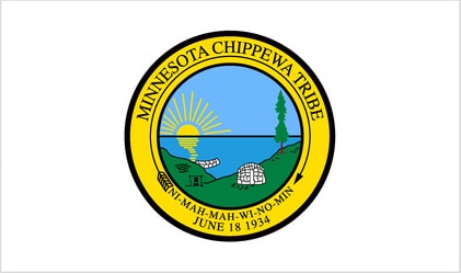
Minnesota Chippewa Tribal Seal
U.S. ©, Fair Use
Anishinabe – The People
Today’s Population estimate (2010)
Tribe alone: 170,742 Ojibwe (US), 160,000 (Canada)
see also:
Wk. 23, 06/05/1957 – Frances Theresa Densmore
*
![]()
Fox
aka: Mesquaki

Sac and Fox Great Seal
Image: U.S. ©, Fair Use
Today’s Population estimate (2024)
Tribe alone: 3,500
![]()
Huron
aka: Wyandot, Wyandotte, Wendat, Waⁿdát
Today’s Population estimate (2024)
Tribe alone: 4,578
see also:
The Originals Index – Native American Tribes –
Native American Pre-History – Destroyed by a Comet
![]()
Illinois
originally spread over what are now southern Wisconsin and northern Illinois and parts of Missouri and Iowa.
The best-known of the Illinois tribes were the Cahokia, Kaskaskia, Michigamea, Peoria, and Tamaroa.
These people referred to themselves as the Inoka. The meaning of this word is unknown.
and reside in present-day Oklahoma.
*
![]()
Haudenosaunee Confederacy
aka: Haudenosaunee (6)
Founded by the Great Peacemaker in 1142,
is the oldest living participatory democracy on earth.
Mohawk, Onondaga, Oneida, Cayuga, Seneca, and Tuscarora
Today’s Population estimate (c.1700)
Tribe alone:
Tribe alone or in any combination:
see:
References – Dictionary – Great Peacemaker & Haudenosaunee
![]()
Iroquois
Originally northeast North America and Upstate New York.
Moved west with the fur trade, became a member of the Iron Confederation. (c. 1840’s)
Today’s Population estimate (2024)
Tribe alone: 47,230
Tribe alone or in any combination: 114,568
see also:
The Originals Index – Native American Tribes –
Native American Pre-History – Destroyed by a Comet
*
![]()
Kickapoo
Kickapoo Great Seal
Image: U.S. ©, Fair Use
Today’s Population estimate (2024)
Tribe alone:
Tribe alone or in any combination:
![]()
Lenape
aka: Delaware

Delaware Tribal Seal
Delaware Seal U.S. ©, Fair Use
The Ordinary People
AKA: Cherokee Delaware or Eastern Delaware (old)
Traditional territory included present day New Jersey, along the Delaware River watershed,
western Long Island and the Lower Hudson Valley
Forced west in the 1800’s and south into Indian Territory, OK in the 1860’s.
Today’s Population estimate (2024)
Tribe alone: 16,000
Tribe alone or in any combination:
see:
Wk. 43, 10/24/1862 – Wichita Agency Massacre)
see also:
The Originals Index – Native American Tribes –
Native American Pre-History – Destroyed by a Comet
![]()
Miami
Today’s Population estimate (2024)
Tribe alone: 5,600
see also:
The Originals Index – Native American Tribes –
Native American Pre-History – Destroyed by a Comet
*
![]()
Ottawa
Ottawa Tribal Seal
Image: U.S. ©, Fair Use
Today’s Population estimate (2024)
Tribe alone: 6,295
Tribe alone or in any combination: 13,866
see also:
The Originals Index – Native American Tribes –
Native American Pre-History – Destroyed by a Comet
![]()
Potawatomi
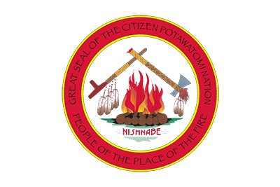
Potawatomi Nation Seal
Image: U.S. ©, Fair Use
Tribal divisions: Mission, Prairie, and Woods c. 1861
Today’s Population estimate (2024)
Tribe alone: 21,297
Tribe alone or in any combination: 43,481
![]()
Powhatan
![]()
Roanoke
![]()
Sac
Sac and Fox Nation Seal
Image: ©, Fair Use
Today’s Population estimate (2024)
Tribe alone: 3,794
![]()
Shawnee
Shawnee Great Seal
Image: U.S.©, Fair Use
Today’s Population estimate (2024)
Tribe alone:
Tribe alone or in any combination:
see:
Wk. 43, 10/24/1862 – Wichita Agency Massacre)
see also:
The Originals Index – Native American Tribes –
Native American Pre-History – Destroyed by a Comet
![]()
Winnebago
Winnebago Tribal Seal
Image: U.S. ©, Fair Use
Today’s Population estimate (2024)
Tribe alone: 12,000
End: Northeast Indian Tribes
Plateau Indian Tribes
* at the bottom of a listing = No seal.
![]()
Coeur d’Alene
Coeur DAlene seal
Image: U.S. ©, Fair Use
Today’s Population estimate (2024)
Tribe alone: 2,190
![]()
Flathead
Today’s Population estimate (2024)
Tribe alone: 7,753
![]()
Kalispel
Kalispel Tribal logo
Image: U.S. ©, Fair Use
Today’s Population estimate (2024)
Tribe alone: 470
![]()
Kootenai
Kooteni Country seal
Image: U.S. ©, Fair Use
Today’s Population estimate (2024)
Tribe alone: 150
![]()
Palouse

Palouse Heritage seal
seal: U.S. PD Palouse Tribe? Fair Use
The Palouse are considered a Plateau tribe of three independent groups. They lived in villages during the winter months in wooden houses. As with other Columbia Basin Indians, their economy depended on salmon fishing in the Columbia River, hunting and gathering berries and roots (such as the camas).
The Palouse were caught up in the late nineteenth century Indian wars, and mistaken for another tribe. Both the Palouse and the Nez Perce were removed from Washington and Idaho and sent to Oklahoma to the Indian Territory. They were unable to return to their home and their ancestors until 1885. The return to their ancestral homes in Idaho and along the Palouse was in great part due to the continuous efforts of Chief Joseph, Yellow Bull, Yellow Bear, and Husishusis Kate (a spiritual leader). Today, Palouse village is gone, but the site is still a site of spiritual worship and salmon for tribes in the area.
Today’s Population estimate (2024)
Tribe alone: not found
see:
Wk. 23, 06/09/1855 – Treaty of Yakama
Just for Fun Pages – Monsters and Supernatural Beings of the Old West – The Beaver’s Heart
*
![]()
Umatilla
Umatilla Confederation Flag
Image: U.S. ©, Fair Use
Today’s Population estimate (2024)
Tribe alone: 2,899
see:
Wk. 23, 06/09/1855 – Treaty of Yakama
![]()
Yakama
Yakama Nation Seal
Seal: Yakama Nation
growing family
Washington territory? (1805)
Fishermen, hunter gatherers
(Yakama War (1855-56)
Today’s Population estimate (2024)
Tribe alone: 8,334
Tribe alone or in any combination: 11,978
see:
Wk. 23, 06/09/1855 – Treaty of Yakama
End: Plateau Indian Tribes
Southeast Indian Tribes
* at the bottom of a listing = No seal.
As with other Eastern Native Americans, there are not too many references here, as most interactions were in the European settlement and “Revolutionary” times in the Eastern U.S. and precede ” The West” of our focus in Old West Daily Reader. However, among these tribes are the first to have their lands stolen and be forced west to the “Indian Lands“, and they are also usually included as “background” and part of the complete story of Indian and European relation as they unfolded in the “New World”.
see:
The Originals – Battlefields and Massacres
![]()
Alabama
{camp, make place to camp}
Alabama. Farmers, hunter gatherers (1540).
*
Today’s Population estimate (2024)
Tribe alone: 380
see:
Muscogee Nation – above
![]()
Apalachee
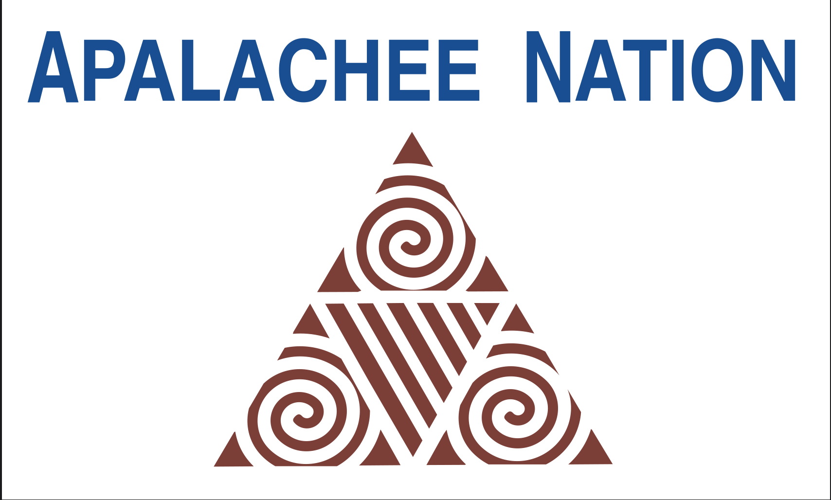
Apalachee Nation Flag
Image: U.S. ©, Fair Use
Today’s Population estimate (2024)
Tribe alone: 250 – 300
![]()
Caddo
Caddo Nation Logo
Image: U.S. ©,Fair Use
Today’s Population estimate (2024)
Tribe alone: 5,800
![]()
Cherokee

ni-Yun’wiya
The Principal People
Virginia, West Virginia, Kentucky, Tennessee, Georgia, Alabama (1540)
South and then to Indian Territory in Oklahoma.
Farmers, hunter gatherers, fishermen, reservation.
These were the first victims of a mass re-location, British (1700’s), Americans (1800’s)
The Apache tribes had fought the invading Spanish and Mexican peoples for centuries.
The first Apache raids on Sonora appear to have taken place during the late 17th century.
In 19th-century confrontations during the American Indian wars,
the U.S. Army found the Apache to be fierce warriors and skillful strategists.
Today’s Population estimate (2024)
Tribe alone: 292,555
Tribe alone or in any combination: 1,116,990
see also:
Wk. 22, 05/28/1830 – Indian Removal Act
Wk. 11, 03/18/1831 – Cherokee Nation v. Georgia
![]()
Chickasaw
Chickasaw Great Sea
Image: U.S. ©, Fair Usel
Today’s Population estimate (2024)
Tribe alone: 29,699
Tribe alone or in any combination: 72,440
see:
Wk. 22, 05/28/1830 – Indian Removal Act)
![]()
Choctaw
Choctaw Nation Great Seal
Image: U.S. ©, Fair Use
Today’s Population estimate (2024)
Tribe alone: 100,605
Tribe alone or in any combination: 255,677
see:
Wk. 22, 05/28/1830 – Indian Removal Act
![]()
Creek
(dbl listed)
Creek Muscogee Nation Seal
Image: U.S. ©, Fair Use
Today’s Population estimate (2024)
Tribe alone: 44,041
Tribe alone or in any combination: 108,368
see:
Wk. 22, 05/28/1830 –Indian Removal Act
Muscogee Nation – above
![]()
Seminole
Seminole Great Seal
Image: U.S. ©, Fair Use
Today’s Population estimate (2024)
Tribe alone: 14,229
Tribe alone or in any combination: 41,411
see:
Wk. 22, 05/28/1830 – Indian Removal Act
Wk. 43, 10/24/1862 – Wichita Agency Massacre
End: Southeast Indian Tribes
Southwest Indian Tribes
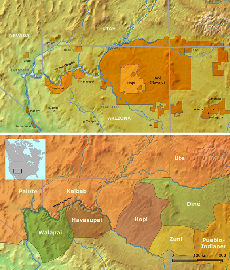
Map: U.S. PD 2007 by Nikater
![]()
For All Pueblo Indian Cultures in New Mexico (18)
see:
The Originals Index – Native American Tribes – Pueblos of New Mexico
![]()
O’odham
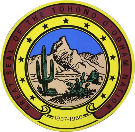
Tohono O’odham Nation Seal
U.S. ©, Fair Use
Akimel O’odham
Pima {river people}
(1694 – Spanish)
Southern AZ, northern Sonora, Mex. lived and farmed along the Salt River.
Farmers, hunter gatherers

Photo of a PDF: U.S. PD 1996
by Barbara Trapido-Lurie
Pima Territory (c. 1700)
Today’s Population estimate (2024)
Tribe alone: 24,121
Tribe alone or in any combination: 30,965
On’k Akimel O’odham
(On’k Akimel Au-Authm) – “Salt River People”
Sonoran Desert in eastern Arizona and northwestern Mexico
Today: the Salt River Indian Reservation.
Farmers, hunter gatherers
Photo of a PDF: U.S. PD 1996 by Barbara Trapido-Lurie – Pima Territory c. 1700
Today’s Population estimate (2024)
Tribe alone:
Tribe alone or in any combination:
Tohono O’odham
{desert people} (Sp. Papago)
Today, the Tohono O’odham Nation (
Tohono O’odham Indian Reservation) is located in southern Arizona,
encompassing portions of Pima County, Pinal County, and Maricopa County. {001}
Today’s Population estimate (2024)
Tribe alone: 25,966
Tribe alone or in any combination: 32,910
Further reference for O’odham Indians:
The Originals – Resources and Hazards – Plants – Food Plants – Beans, Maize, Squash and The Three Sisters
see:
Wk. 02, 01/12/1923 & Wk. 04, 01/24/1955 – Ira Hayes
![]()
Apache Nation
/əˈpætʃi/)
people
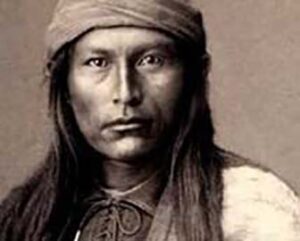
Apache warrior
Photo: U.S. PD? internet
1540) Migrating south from Alaska through Alberta and Wyoming, these Athabaskans had arrived in the American Southwest, sometime in the late 1400’s or early 1500’s. Splitting off from the Navaho, they soon divided into a dozen or more major subgroups throughout the American Southwest: Arizona, New Mexico with some areas in Colorado, Kansas, Oklahoma, Texas and northern Mexico > Florida reservation > Oklahoma reservation. Typically nomadic, raiders, hunter gatherers, some farmers > + horse in late 1600’s; some buffalo hunters. Western Apache tribes were matrilineal, tracing descent through the mother; newlywed couples usually resided in the village of the bride’s kin. society was divided into a number of matrilineal clans. Other groups traced their descent through both parents. Polygamy was practiced to some extent.
Sustained resistance to invasion by Mexicans (from the late 1500’s) until forced to make alliances due to pressure from the Comanche. Resistance to the Americans from the late 1500’s until the final capture of Geronimo [Chiricahua – Bedonkohe ] (1886).
The Yavapai Apache Nation is made up of two distinct people: the Yavapai, who refer to themselves as Wipuhk’a’bah and speak Yuman, and the Apache, who refer to themselves as Dil’zhe’e and speak Athabaskan.
The Apache honor four sacred mountains: Sierra Blanca, Three Sisters Mountains, Oscura Mountain Peak, and Guadalupe Mountains. Their homeland includes all of the land surrounding these mountains.
Yavapai – Today, three, primary, groups:
Yavapai Apache Nation
Yavapai-Prescott Indian Tribe.
Apache – Today, Five groups:
Janero
Lipan
Mimbreño
Mogollon
Nednhi or Carrizaleño
Ndendahe (Bedonkohe
Salinero
San Carlos Apache (AZ)
Camp Verde Indian Reservation
Yavapai Apache Nation
Fort Apache Reservation (AZ)
The White Mountain Apache
Fort McDowell Indian Reservation
Mojave Apache
Fort McDowell Yavapai Nation
Fort Sill Reservation (OK)
Chiricahua (great mountain)
They call themselves, Aiaha.
Their former home was in the mountains of Southeast AZ.
+ horse in late 1600’s; raiders, slavers, * the most warlike tribe in AZ.
Their raids extended into NM, southern AZ, and northern Sonora, MX.
sub group – Bedonkohe
The Jicarilla Reservation (1887) (NM)
Located in northwest NM with Tribal Headquarters in Dulce, NM.
Jicarilla Apache Nation (Ndee, translates as “the People.”)
Haisndayin – translates as “people who came from below”.
By the early 1600s, the Jicarilla were living from the Chama Valley in present-day NM
east to present-day western Oklahoma.
Estimated at about 800 people at the time of first contact with Europeans (c. 1700’s).
Generally matrilineal, tracing descent through the mother,
newly wed couples usually resided in the village of the bride’s kin.
Society was divided into a number of matrilineal clans.
The Llanero (“plains people”) lived in adobe houses with nearby farms
in the eastern Sangre de Cristo Mountains.
Over time, they added some social and religious customs
and the making of pottery from the pueblos around them (particularly Taos).
The Ollero (“mountain-valley people”) + horse in late 1600’s; Nomadic buffalo hunters
who gained some Plains Indian technology: parfleches, tipis, and travois.
In time, they gave up much of the plains lifestyle.
 FYI: The Clown is a sacred being with great Power, bestowed upon him by Thunder (the “Thunder-Beings”). He represents the fear of a tremendous power in the sky, far greater than anything on the Earth. The Clown, “fooling around,” is a actually a serious spiritual element of ceremony. His seemingly mad behavior reflects the randomness of catastrophe. Just as nature, from time to time, reminds us of our own mortality.
Members of the Jicarilla Clown Society smear their bodies with white clay, then paint four horizontal black stripes on Their face, body and legs. The tribal name for these clowns translates, “Striped Excrement.”
The Clown is thought to have been adopted from the Pueblo Culture by the Apache sometime after their arrival in the Southwest (mid-1500’s). Photo: U.S. PD Wikipedia – A Pueblo Sacred Clown. {001}
Mescalero Reservation (NM)
Mescalero Apache
San Carlos Reservation
Aravaipa
Chiricahua
(see: Fort Sill info – above)
Tonto Apache Reservations (AZ)
Camp Verde Indian Reservation
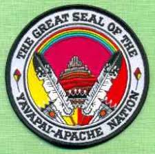
Yavapai Apache Nation
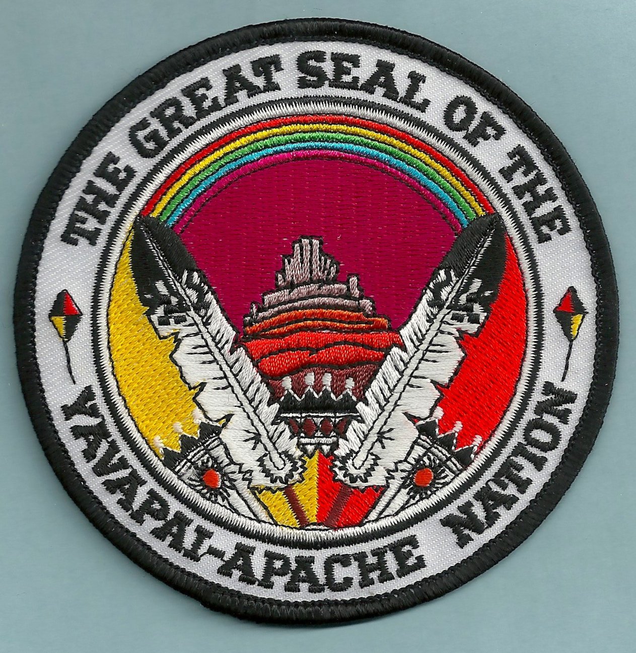
Yavapai Apache Nation Seal
Image: U.S. ©, Fair Use
Ranging from the Colorado River to the Tonto Basin
Divided into four subtribes:
Kewevkapaya (Southeastern)
Tolkapaya (Western)
Wipukpaya (Northeastern)
Yavepe (Northeastern)
White Mountain Reservation (AZ)
Chiricahua
(see: Fort Sill info – above)
Apache-Wikiup – by Edward-Curtis
U.S. PD Wiki
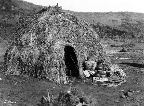
Apache woman weaving a basket
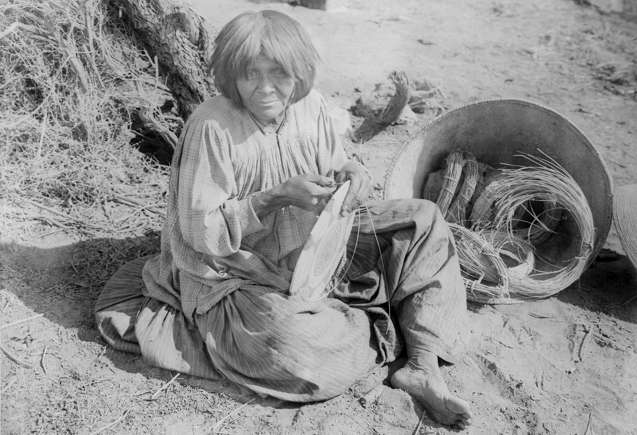
U.S. PD Wiki

Apachean tribes, c. 18th century: WA: Western Apache N: Navajo
Ch: Chiricahua M: Mescalero J: Jicarilla L: Lipan Pl: Plains Apache
Map – Native languages and language families of North America – Ives Goddard, (1996)
Today’s Population estimate (2024)
Tribe alone: 30,000
see:
Wk. 36, 09/08/1886) – Chiricahua Apaches
References – Dictionary – Panana
Wk. 36, 09/04/1886 – Geronimo
The Originals Index – Lost Treasures in the Old West – Skulls (Geronimo)
Comanche – above
Wk. 43, 10/24/1862 – Wichita Agency Massacre
Kiowa – above
![]()
Caddo
Caddo Nation Seal
Image:; U.S. ©, Fair Use
Today’s Population estimate (2024)
Tribe alone:
Tribe alone or in any combination:
![]()
Chemehuevi
CHEH-mih-WAY-vee
(no logo)
The Chemehuevi – An indigenous people of the Great Basin, the southernmost branch of Southern Paiute.
A nomadic people living in small groups due to the sparse resources available in the desert environment.
Today, Chemehuevi people are enrolled in the following federally recognized tribes:
Colorado River Indian Tribes *
Chemehuevi Indian Tribe of the Chemehuevi Reservation
Morongo Band of Mission Indians
Cabazon Band of Mission Indians
Agua Caliente Band of Cahuilla Indians
Torres-Martinez Desert Cahuilla Indians
Twenty-Nine Palms Band of Mission Indians of California
Some Chemehuevi are also part of the Soboba Band of Luiseño Indians,
whose members are mostly Sovovatum
or Soboba band members of Cahuilla and Luiseño people.
Population as of 2020 is in the thousands.
see:
* Residents on the Colorado River Indian Reservation (1870)
Mojave – below
![]()
Dineh
(Navajo)
The People
They settled in New Mexico and parts of southern Colorado and Utah > Arizona reservation(1500’s)
, They are Athabaskans, who migrated south from Alaska via Alberta and Wyoming,
arriving in the American Southwest sometime in the late 1400’s or early 1500’s.
Archaeological finds, dating to around 1500 and considered to be proto-Navaho,
have been located in northern New Mexico around the La Plata, Animas and Pine rivers.
Hunter gatherer raiders > farmers, herders, silversmiths, weavers.
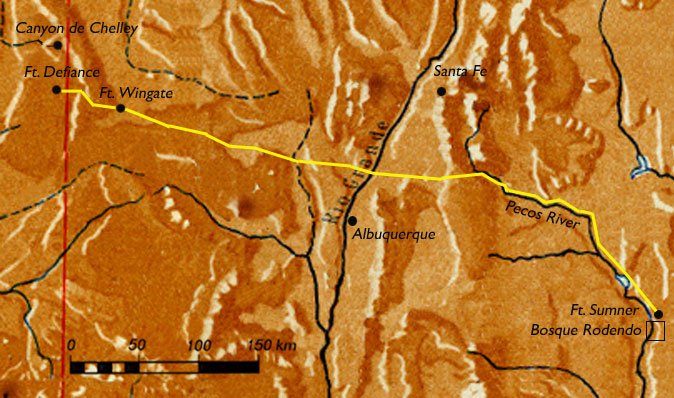 Long Walk – The Long Walk of the Navajo, * (Navajo: Hwéeldi),
  aka, the Long Walk to Bosque Redondo. 53 forced marches occurred between August 1864 and the end of 1866. The U.S. government, via the army, forced the Navajo people to walk from their reservation in what is today’s Arizona to be relocated in Bosque Redondo, eastern New Mexico. {001}
see also:
References – Dictionary – Long Walk
Today’s Population estimate (2024)
Tribe alone: 332,389
Tribe alone or in any combination: 399,567
The Navajo Nation is the largest tribal land in the U.S.
It covers almost 27,000 square miles, including parts of Arizona, Utah, and New Mexico.
see:
Wk. 38, 09/22/1861 – Fort Wingate Massacre)
The Originals Index – Landmarks and Registers – Shiprock)
![]()
Havasupai
Havaupai Nation Seal
Image: U.S. ©, Fair Use
Today’s Population estimate (2024)
Tribe alone:
Tribe alone or in any combination:
![]()
Hopi
Hopi Nation Flag
Image: U.S. ©, Fair Use
Pueblo, farmers, Philosophers
European contact came with Coronado expedition explorer Don Pedro de Tovar,
who encountered the Hopi while searching for the legendary Seven Cities of Gold (1540).
The Hopi are a Native American ethnic group who primarily live on the Hopi Reservation in northeastern Arizona.
As of the 2010 census, there are 19,338 Hopi in the country
Today’s Population estimate (2024)
Tribe alone: 17,164
Tribe alone or in any combination: 25,438
![]()
Hualapai
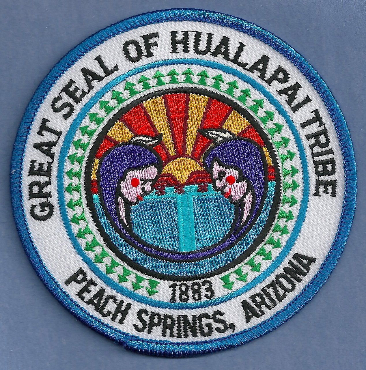
Hualapai Arizona Tribal Seal
Image: U.S. ©, Fair Use
Today’s Population estimate (2024)
Tribe alone:
Tribe alone or in any combination:
![]()
Mojave
‘Aha Makhav
Mojave Tribal Seal
Image: U.S. ©, Fair Use
Mojave War (1857 – 59)
Mojave – aka: Mohave – A Native American people indigenous to the Colorado River in the Mojave Desert. The Fort Mojave Indian Reservation (1865) includes territory within the borders of California, Arizona, and Nevada. The Colorado River Indian Reservation (1870) includes parts of California and Arizona and is shared by members of the Chemehuevi, Hopi, and Navajo peoples. Both reservations include substantial senior water rights in the Colorado River. The is used for irrigated farming.
Today’s Population estimate (2024)
Tribe alone:
Tribe alone or in any combination:
see:
Wk. 31, 08/04/1859 – Colorado River
Wk. 12, 03/20/1903 – Olive Oatman![]()
Yaqui
Pascua Yaqui Tribal Seal Image: U.S. © Fair Use
The Yaqui, Hiaki – aka: Yoeme. Indigenous people of Mexico, including a Native American tribe in Arizona. They speak the Yaqui language (an Uto-Aztecan language). The original homelands are in the Río Yaqui valley in the northwestern state of Sonora (Mexico). Eight Yaqui Pueblos remain in today’s Sonora.
Some Yaqui, fleeing state violence (Mexico), settled in what was to become Arizona (early 1900’s). They formed the Pascua Yaqui Tribe of Arizona, based in Tucson, AZ, today, the only federally recognized Yaqui tribe in the United States.
Today’s Sonora and Sinaloa Population estimate (2024): 16, 240
Today’s Arizona Population estimate (2023): 22,412
Tribe alone or in any combination: 38,352
![]()
Yuma Quechan
Yuma Quechan Tribal Seal
Image: U.S. © Fair Use
[Quechan] {people of the river}
Western Arizona and southeastern California. Farmers, fishermen/hunters (1540).
Today’s Population estimate (2024)
Tribe alone: 8,129
Tribe alone or in any combination: 11,817
![]()
End: Southwest Indian Tribes
Further insight into the Indians of the time may be found in:
The Originals Index – Native American Tribes – Native American Pre-History
The Originals Index – Native American Tribes –
Native American Pre-History – Destroyed by a Comet
Timelines – Timelines M-Z – Time to Ponder – First Article – Discovery Doctrine
The Originals Index – Native American Tribes – Pueblos of New Mexico
PLAYERS – Timelines Index – Timelines A-L Index – Indian Treaties Timeline
PLAYERS – Timelines Index – Timelines A-L Index – Indian Wars Timeline
The Originals Index – Landmarks and Registers
Quotes Index – Indian Quotes
The Originals Index – Resources and Hazards
The Originals Index – The Pemmican Trade
Originals Index – Cow? What cow? – Buffalo?
for more photos of Indians in Old West Daily Reader
See :
Photo Gallery Index – Indian Photos
Photo Gallery Index – Indian Photos – Indian Portrait Gallery
Photo Gallery Index – Indian Photos – Indian Chiefs Photos
Just for Fun Pages – Indian Warrior Women
Photo Gallery Index – Military Photos – Indian Scouts
see also:
The Originals Index – Horses
References – Dictionary
References – Dictionary – “N” The N Word
References – Dictionary – Racism
Modern references:
Wk. 38, 09/21/2004 – National Museum of the American Indian
Wk. 33, 08/15/1977 – American Indian Institute
Links to Friends –Indian Pueblo Cultural Center – New Mexico
As always with Old West Daily Reader, this is a light touch on a vast and complex subject. Hopefully, Native American Tribes has enough information to start and/or enrich your own explorations into the amazing world of the First Americans. – Doc
Any mistakes or errors in this entire section are solely mine.
Please feel free to offer suggestions or corrections.
I want the information here to be accurate. email me.
Contact – Doc B.
![]() End: Native American Tribes
End: Native American Tribes
Go to: Indian Photos
Go to: Photo Gallery Index
Go to: Battlefields and Massacres
Go to: Massacres by Indians
Go to: Massacres of Indians
Go to: Chief Red Cloud’s address to the “Great Father – 1870
Go to: Dakota War (1862)
Go to: Indian Agents
Go to: Commerce in the Old West
Go to: Trade in the Old West
Go to: Beads in Old West Trade
Go to: Indian Warrior Women
Go to: Pueblos of New Mexico
Go to: Native American Pre-History
Go to: Horses
Go to: Cow? What cow? – Buffalo?
Go to: Edged Weapons
Go to: Handguns
Go to: Long Guns
Go to: References
Go to: Dictionary
Go to: Just for Fun Pages
Return to: Home Page
{001} C 05/25; Ee 05/25; F 05/12; P 05/25
[whohit]-Native American Tribes-[/whohit]