Use Cmd/Ctrl+F to search Old West States that Never Were
Working links are Red, other references, use Navigation Panel choices.
Names in bold will be found in Players or Dictionary
Bolded Titles in References– Books (two lists).
Old West States that Never Were
 All photos and maps included here are in the Public Domain in the United States of America unless noted otherwise. Western photographers are noted in the Players (if I have a workable date for them) [LOC = Library of Congress]. Nothing in the way of enhancement has been done to these photographs they are as originally produced.
Old West States that Never Were makes note of states proposed to be added to the Union that were unsuccessful for numerous reasons. Various groups had their own agendas. These are only the Western ones, back East, there were many more…
History Riders Please Note:
In an effort to preserve dates and details, this entire page,
with some editing for clarity, is taken from Wikipedia. – Doc

The State of Deseret – 1849 -1850
As soon as the Mormon pioneers (LDS Church members *), seeking Zion, ** settled in the Salt Lake Valley near the Great Salt Lake, they intended to set up a government which would be recognized by the United States (1846). At the time, the land was still a part of Mexico.
Deseret’s government was to be a Theodemocracy *** with a governor, a lieutenant governor, a bicameral state legislature of 17 senators and 35 representatives (all, free white male citizens) and a supreme court. Three sessions of the General Assembly were held. The state constitution went into effect 05/10/1847, silent on the matter of slavery. A provisional state government operated for nearly two years (1849 – 1850). Prior to the establishment of the Utah Territory and in the absence of other authority, the provisional government of Deseret became the de facto government of the Great Basin. At first, church president Brigham Young **** sent a petition to Washington, D.C. for territorial status.
Deseret would have comprised roughly all the lands between the Sierra Nevada and the Rocky Mountains between the border with Mexico northward, including parts of the Oregon Territory and the California coast south of the Santa Monica Mountains with the existing settlements of Los Angeles and San Diego. It was to include the entire watershed of the Colorado River (excluding the lands south of the border with Mexico), as well as the entire area of the Great Basin. It also encompassed nearly all of present-day Utah and Nevada, large portions of California and Arizona, and parts of Colorado, New Mexico, Wyoming, Idaho and Oregon.
Sufficient opposition arose such that it was never recognized by the U.S. Soon realizing that California and New Mexico were applying for admission as states, Young changed his mind and petitioned for statehood.
see also:
* Church of Jesus Christ of Latter-Day Saints
** References – Dictionary – Zion
*** References – Dictionary – Theocracy, Theodemocracy
**** Timelines Master Index – Timelines M-Z – Brigham Young Timeline
Timelines Master Index – Timelines M-Z – Mormon Timeline

The Utah Territory is shown in blue, the proposed State of Deseret is outlined by the dotted line.
Modern state boundaries are underlaid for reference. The provisional state encompassed most of the territory that had been acquired from Mexico the previous year as the Mexican Cession. * Mormon planners utilized a map drawn by Charles Preuss based on survey data from John Charles Frémont **
published by order of the U.S. Senate (1848).
see:
* References – Dictionary – Mexican American War (1846- 1848)
** The Originals Index – Expeditions – John C. Fremont
Congress denied the Deseret territorial petition (1849), providing instead the Utah Territory as part of the Compromise of 1850. The Utah Territory encompassed a portion of the northern section of Deseret (09/09/1850). Congress decided that the question of whether slavery would be allowed in the territory would be decided by the territory’s residents. The territorial legislature appointed judges and established a criminal code(1850). Taxes were established on property, and liquor and gambling were outlawed. The LDS Church was incorporated and a militia, based on the Nauvoo Legion, * was formed. Brigham Young was inaugurated as the first governor of the Utah Territory (02/03/1851). The General Assembly of Deseret passed a resolution to dissolve the state (04/04/1851). The Utah territorial legislature voted to re-enact the laws and ordinances of the State of Deseret (10/04/1851).
Even after the establishment of the Utah Territory, the Latter-day Saints did not relinquish the idea of a “State of Deseret.” From 1862 to 1870, under Young’s leadership, a group of Mormon elders met as a shadow government after each session of the territorial legislature to ratify the new laws under the name of the “State of Deseret.” Attempts were made in 1856, 1862, and 1872 to write a new state constitution under that name, based on the new boundaries of the Utah Territory.
At Promontory Summit, only 66 miles from Salt Lake City, driving a golden spike had completed the transcontinental railroad (1869). The LDS Church supported the railroad and Young had allowed church members to work on the Union Pacific railroad. While it provided growth in commerce across the territory, it also opened the territory, particularly in the western areas, to numerous settlers, many of whom were not Mormon. The hope and fantasy of creating a Mormon state began slowly fading away. {001}
see:
* References – Dictionary – Nauvoo Legion

The Deseret Stone used in the construction of the Washington Monument.
The stone was donated by the territory in 1853 to represent the provisional state.
see:
Timelines M – Z – Mormon Timeline

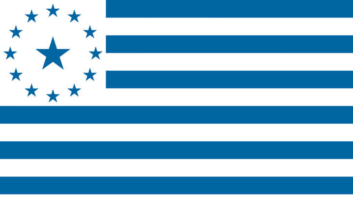
The State of Jefferson – 1859

State of Jefferson flag
and Great Seal U.S. PD? internet
Northwest California‘s gold rush in the Klamath River Basin extended further north and into the Rogue River Valley of southern Oregon (1851). This led to the first large influx of white settlers in the area and sparked conflict with local Native American populations. The State of Jefferson was actually proposed for four regions. Local politicians proposed an independent State of Shasta to the California legislature (1852), but the bill died in committee. The State of Shasta was revived again (1855), and various other configurations of an independent state in the same region as the State of Jefferson were proposed throughout the decade (such as the State of Klamath (1853 and 1854). Political confusion and too many settlers eventually culminated in the Rogue River War (1855–1856). * Settlers of the region believed that they were distinct from the rest of California and Oregon culturally and economically and because of the large distance separating them from the capitals of California and Oregon, it appeared that their needs would be better addressed at the local, and federal levels, by their own State government.
A number of mining communities in the Rocky Mountains united to request the creation of a state west of Kansas Territory (1859). The proposal was accepted by the Kansas government; however, the affected citizens could not agree on a constitution, and instead, the proposed state became known as the Jefferson Territory and later the Colorado Territory. The proposed State of Jefferson was to have spanned the contiguous, mostly rural area of southern Oregon and Northern California (where attempts to separate from Oregon and California, respectively, had already occurred. The state would have included most of Northern California’s land but excluding San Francisco and several other Bay Area counties, which, at the time, included the majority of Northern California’s population (see: map – below). Had the proposal been approved, the capital city would have been determined by a constitutional convention. Congress passed legislation that would allow the region to vote on whether they wanted to be independent from California and Oregon (1860), but the Civil War interrupted independence movements in the West for the rest of the 19th century. {001}
see:
* Wk. 44, 10/31/1855 – Battle of Hungry Hill

A proposed boundary for
>the State of Jefferson
Map: U.S. PD? internet.
The name “Jefferson” is of uncertain local origin. Other than the fact that it had been then President Thomas Jefferson, who had sent the Lewis and Clark Expedition into the Pacific Northwest (1803). At the time, he had envisioned the establishment of an independent nation in the western portion of North America that he dubbed the “Republic of the Pacific”; thus the association of his name with regional autonomy. There were three different statements from separate influential individuals on the creation of a “Pacific Republic” (1860). Interweaving with all of this, was the movement for independence, rather than statehood, which became known as Cascadia (beginning around 1843). Remembered, reformed, rebuilt, repurposed, it lives on today.

The State Lincoln – 1869

Proposed flag – U.S. PD? internet
Congress had wanted to split Texas into several parts (1845). One of these would have been the State of Lincoln (1869), this would have comprised the area south and west of the Colorado River. There were, however, other proposals to create a State of Lincoln. When a number of states were created in 1864, the Idaho Panhandle (now part of Idaho) proposed to become a state called Lincoln. Then in the 1900s, there was a new proposition, this time including Eastern Washington. In fact, the idea was brought up again as recently as 2005. The State of Lincoln has been proposed to consist of the Panhandle of Idaho and Eastern Washington (east of the Cascade Mountains). Other than Lincoln, the names “Columbia” and “Eastern (or East) Washington” were proposed to be used for the state. It was first proposed by Idaho (1865), when the capital was moved from Lewiston (12/1864) to its present-day location of Boise (01/1865), in an Idaho greatly reduced in land area. The original Idaho Territory, from a bill signed by President Lincoln (March 1863), was declared by Governor William H. Wallace in Lewiston (07/04/1863), it included present-day Idaho, and virtually all of present-day Montana and Wyoming, making it larger in land area than Texas. Montana was made a territory and the Panhandle was specifically excluded in order to prevent Lewiston, west of both the Continental Divide along the crest of the Rockies and of the Bitterroot Range, from remaining the capital (1860). The reasoning was that Lewiston sits on the western edge, across the Snake River from Washington, whereas Montana stretches to North Dakota.
There was a proposal centered on Lewiston in northern Idaho for a Columbia Territory to be formed in the Inland Northwest from parts of what is now eastern Washington, northern Idaho and western Montana (late 1860’s). Another proposal was made, this time to combine the Idaho Panhandle with Eastern Washington to create the state of Lincoln (1901).
A third proposal was popularized to consist of eastern Washington, northern Idaho and western Montana to the Continental Divide (1920’s). From the Washington end, proposals have been made recently (1996, 1999 and 2005). Idaho saw a corresponding campaign for North Idaho, financed by the sale of T-shirts reading “North Idaho – A State of Mind”.
Lincoln is the name for several proposals to create a new state in the Northwest United States. The proposed State has been defined in multiple ways, but can generally be said to be coterminous with the region known as the Inland Northwest. The proposed state was named in honor of Abraham Lincoln, who was president during the American Civil War. His name had also been proposed for the states that were eventually named North Dakota and Wyoming.

Lincoln’s proposed location in the United States
North Idaho
While the disconnection between Western Washington and Eastern Washington is well known and documented, North Idaho has a similar dynamic in which its residents often feel disconnected from the state’s political center in Boise. The Idaho Panhandle is most often considered to be the ten northernmost counties in the state—Boundary, Bonner, Benewah, Clearwater, Idaho, Kootenai, Latah, Lewis, Nez Perce, and Shoshone. These counties are separated from Southern Idaho by the Salmon River and observe Pacific Time, unlike the rest of the state, which uses Mountain Time. Parallel suggestions of a “State of Kootenai” have been made, referring to a proposed union of the six northernmost counties of Idaho, and the six westernmost counties of Montana, creating a geographically, politically, and ecologically connected state of 524,888 residents, putting it ahead of other states such as Wyoming.
Eastern Washington and eastern Oregon
Other conceptions of a potential “State of Lincoln” have been rendered, specifically a possible combination of eastern Washington and eastern Oregon. The people of Eastern Oregon also often express the same frustration with being coupled with Portland and the region west of the Cascades that Eastern Washingtonians do with respect to Seattle. This proposed coupling would create one of the largest states by area in the country, stretching all the way from the eastern foothills of the Cascade Mountain Range to the border with Idaho in the east. The state legislatures for Idaho and Washington have seen bills proposing secession or splintering. Idaho would not go along as at the time the Panhandle generated more tax revenue per capita than the south. If combined with the proposed State of Jefferson, which overlaps a proposed Oregon-Washington “State of Lincoln” in southeastern Oregon and is proposed for many of the same reasons, it would create a state that is even larger. The Inland Northwest region roughly corresponds to the area that might comprise such a State of Lincoln. The largest city would be Spokane, Washington, which is presently Washington’s second largest and the greater Spokane area is the third largest population base in the northwestern U.S. behind Seattle and Portland. A Spokane proposal in 1907 called for a new state “Lincoln” to be created from eastern Washington, northeastern Oregon, and northern Idaho. Oregon and Washington’s eastern boundary would have been shifted westward to 120° W, aligning with California’s eastern boundary. Idaho’s northern boundary would have been shifted southward to 45° N, aligning with Wyoming’s northern boundary. Wyoming‘s northern boundary.

State of Sequoyah – 1905
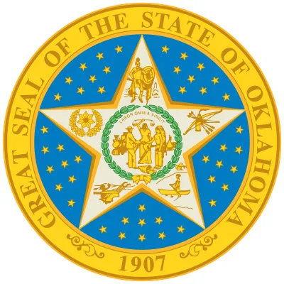
The State of Sequoyah was a proposed state to be established from the Indian Territory in the eastern part of present-day Oklahoma. In 1905, with the end of tribal governments looming (as prescribed by the Curtis Act of 1898), Native Americans of the Five Civilized Tribes—the Cherokee, Choctaw, Chickasaw, Creek (Muscogee), and Seminole—in Indian Territory proposed to create a state as a means to retain control of their lands. Their intention was to have a state under Native American constitution and governance. The proposed state was to be named in honor of Sequoyah, the Cherokee who created a writing system in 1825 for the Cherokee language.

Oklahoma and Indian Territories (1900)- U.S. PD? internet

Approved 1905 by referendum.
Denied by United States Congress.
Annexed to the State of Oklahoma in 1907.
Starting in 1890, when Congress passed the Oklahoma Organic Act, the land that now forms the State of Oklahoma was made up of two separate territories: Oklahoma Territory to the west and the Indian Territory to the east. The Indian Territory had a large Native American population. The territory had been reduced by required land cessions after the Civil War, land runs, and other treaties with the United States. In the 1900 US Census, Native Americans composed 13.4 percent of the population in the future state. By 1905, the Five Civilized Tribes comprised about 10% of the Indian Territory’s total population of around 600,000 people. Until 1903, the Five Civilized Tribes and other tribes in Indian Territory had generally opposed all local and national efforts for statehood, whether they were single or joint with Oklahoma Territory. That changed as the date set by Congress for the breakup of tribal governments and communal lands in the territory approached (03/04/1906). The desire of tribal leaders to retain their historic authority and for the territory to be admitted as a single state, apart from Oklahoma Territory, culminated at the Sequoyah Convention, which met as a whole in 1905 on August 21 and 22 and September 5 to 8. General Pleasant Porter, Principal Chief of the Creek Nation, was selected as president of the convention (08/21/1905). The elected delegates decided that the executive officers of the Five Civilized Tribes would also be appointed as vice-presidents: William C. Rogers, Principal Chief of the Cherokees; William H. Murray, appointed by Chickasaw Governor Douglas H. Johnston to represent the Chickasaws; Chief Green McCurtain of the Choctaws; Chief John Brown of the Seminoles; and Charles N. Haskell, selected to represent the Creeks (as General Porter had been elected President). Muscogee journalist Alexander Posey served as secretary.The convention drafted a constitution, drew up a plan of organization for the government, put together a map showing the counties to be established, and elected delegates to go to the United States Congress to petition for statehood, along with 2 Democrats and 2 Republicans who were to serve as congressmen.
Voters in the territory approved the constitution and statehood petition by 56,279 to 9,073 (11/07/1905). President Theodore Roosevelt then proposed a compromise that would join Indian Territory with Oklahoma Territory to form a single state and resulted in passage of the Oklahoma Enabling Act, which he signed (06/16/1906). Oklahoma became the 46th state (11/16/1907). Although the State of Sequoyah never came into existence, its constitution made an important contribution to Oklahoma history by its many similarities to the later Oklahoma Constitution. They shared an underlying populist distrust of elected officials. The convention also catapulted Haskell, Murray, and others further into the public arena, securing for Indian Territory a solid seat at the debate at the Oklahoma Constitutional Convention.

Jefferson Territory – Texas
Congress wanted to split Texas into several parts (1845). One of these would have been the State of Lincoln (1869), this would have comprised the area south and west of the Colorado River. There were, however, other proposals to create a State of Lincoln. It has been historically used for other proposed territories or states as well, the 19th century “Jefferson Territory,” as well as a southern state that would be created from the Texas Panhandle region, as proposed by a bill in the Texas Legislature (1915). However, the region on the Pacific Coast is the more famous.
The second and third proposed regions were both located in Texas, when its admission into the U.S. was being discussed. The second area was proposed (1870), and comprised southeastern Texas, from the San Antonio River onward. The third was proposed (1915), but this time, Jefferson would be located in western Texas instead. None were approved.

Alternative Names for Current States
North Dakota
It was proposed to split Dakota Territory into northern and southern halves while being considered for statehood in the 1880s. Republicans in the Senate suggested the name “Lincoln” for the northern half, despite objections from residents from the territory, which drew strong objection from the Democrats. Ultimately the territory was admitted in 1889 as two states, North Dakota and South Dakota.
Wyoming
When the 1868 bill to form Wyoming Territory was first discussed in the U.S. Senate, an amendment was proposed that would have changed its name to Lincoln Territory after the assassinated U.S. president Abraham Lincoln. The new name was supported by the Senate Committee on Territories, however it started a debate that scrutinized both “Lincoln” and “Wyoming”, with several members preferring local and Indian names. Multiple senators objected to naming a territory after a single man, acknowledging Washington Territory (named in 1853 for George Washington) as the sole exception. “Wyoming” was the simple English transliteration of the Lenape Indian tribe’s word for “large plains”, which was considered descriptive of the land but undesirable due to its distant origin in Pennsylvania. The bill eventually passed both houses of Congress with the name “Wyoming Territory”, and the Wyoming name was retained when statehood was achieved in 1890.

for further references related to Old West States that Never Were on Old West Daily Reader
see:
Timelines M – Z – Mormon Timeline
The Originals Index – Native American Tribes
 End: Old West States that Never Were
Go: to Dictionary
Go to: References
Return to: Home Page
{001} C 04/25; E 04/25: F 04/24; P 04/24